
Since 1980, the expansion of extensive cattle farming and the opening of the Transchaco Highway have driven massive deforestation, fragmenting forests, reducing wildlife populations and putting pressure on indigenous territories. The socio-environmental crisis has worsened, making the Chaco one of the most deforested regions in the world. Large areas were converted into pastureland for livestock and mechanised crops such as soya and cotton; according to Global Forest Watch, around 20% of the Gran Chaco forest was lost.
Executive summary
The Casuarina community, part of the Nivaclé people, has been developing an outstanding model of land management in the Paraguayan Chaco, a region characterised by high biodiversity and ecological fragility.
Faced with growing pressure on the forests, resulting from deforestation, the expansion of livestock farming and the advance of agribusiness, the community has spearheaded a forest certification process that integrates indigenous knowledge with technical standards for sustainable forest management. This process has helped to strengthen territorial governance, conserve native forest, maintain and improve livelihoods, and highlight and reaffirm the role of Indigenous Peoples as key actors in the conservation and protection of biodiversity.
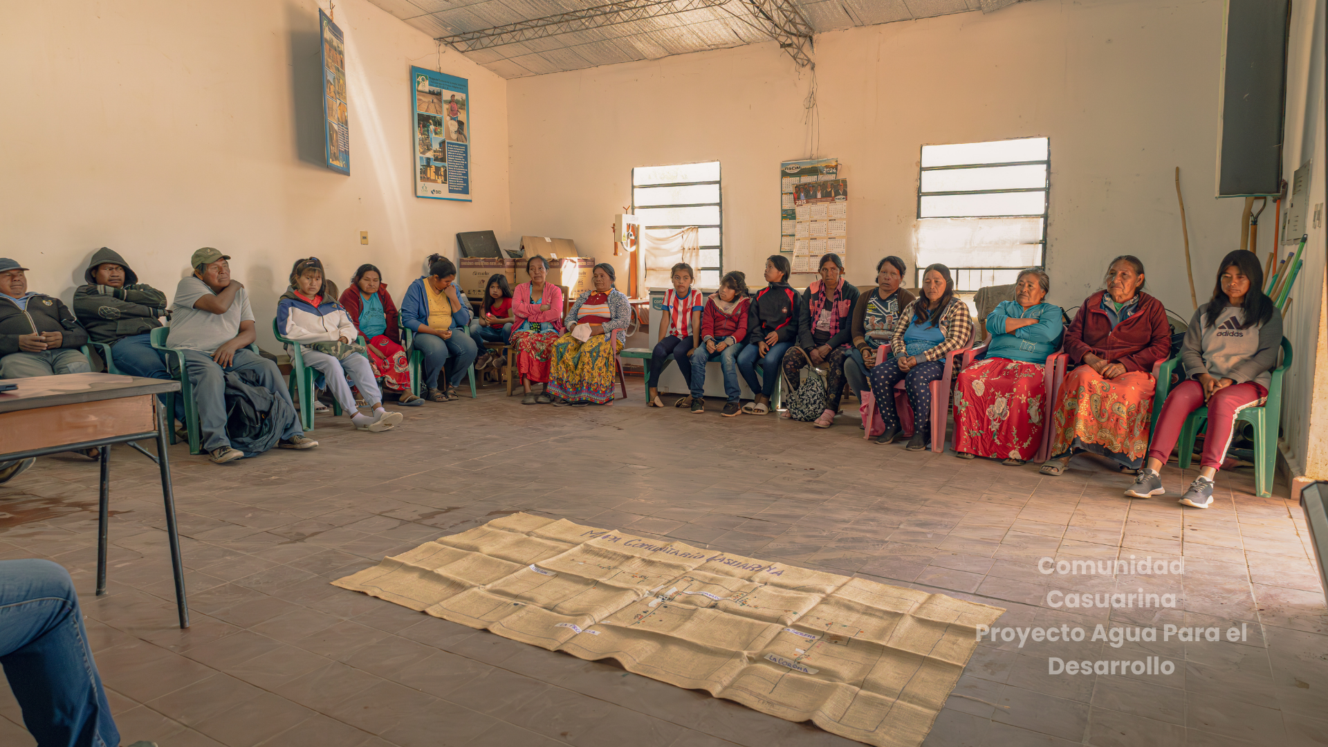
Caption: Meeting with women and young people from Casuarina. Credit: Tina Alvarenga
Sociocultural and territorial contexts
The Nivaclé people have historically maintained a close relationship with the forest, based on traditional knowledge, the sustainable use of resources, and the management of their territory in accordance with community norms. However, their territory has undergone major changes due to the deforestation of some 40,000 hectares in neighbouring areas over the last decade, driven by the expansion of intensive livestock farming and mechanised agriculture (soya and cotton).
This has led the community to reinforce conservation practices as a strategy for territorial defence, food security and socio-cultural strengthening. Key issues include the loss of biodiversity and the decline in wildlife populations, as well as aerial spraying with agrochemicals that affect indigenous and peasant communities (referred to as ‘Latinos’ or ‘non-indigenous people’), damaging native forests, bee populations and traditional production systems.
Similarly, water systems have been disrupted by the destruction of palaeo-riverbeds and natural river courses. This results in the loss of traditional water collection systems, leading to increased losses in production for self-sufficiency and income due to the persistent drought affecting them. Added to this is the deterioration of infrastructure (primarily roads) caused by the daily passage of heavy goods vehicles – estimated at around 50 lorries a day – resulting in the destruction of community roads maintained using their own resources.
Community organisation and governance, livelihoods and the integration of knowledge
The community has a solid organisational structure and a range of productive initiatives. It has a community livestock operation comprising approximately 700 head of cattle, as well as a traceability system that enables better control and management. In other words, thanks to a registration and monitoring system operated by the National Service for Animal Quality and Health (SENACSA) and the community’s own register, the small number of head of cattle makes it possible to trace the origin, management, health and movement of cattle reared on indigenous lands or within indigenous communities from birth through to sale.
It also has a robust accounting system that manages a community budget allocated primarily as follows: health (18.5%), education (24.5%), infrastructure (12%) and food security (45%).
They have machinery for mechanised soil preparation, which families are allocated a few hours’ use of each year (during the sowing season). The agricultural calendar is based on the rainy season, and production is intended for self-consumption and rental income.
Land monitoring and analysis
The identification of forest species and their uses, drawing on traditional Nivaclé knowledge, enabled the identification of key species that still exist and form part of their food system, as well as medicinal plants that form the basis of their traditional medicine. Furthermore, the forest inventories carried out by biologists provided data on density, regeneration, conservation status and threatened species, integrating both scientific and traditional knowledge into the environmental management plan. This collaboration was the result of a relationship of trust between the professionals and the community and its leaders, primarily because the current leader, Don Graciano Ramírez, has worked for over 15 years at a non-governmental organisation (Comité de Iglesias) as a field technician, and whose experience is fundamental to systematic work, with technical assistance from Mennonite advisers at the NGO A Todo Pulmón.
Workshops were held between technical staff, community leaders and traditional knowledge holders, which fostered the transfer of knowledge and capacity building. These covered the traditional knowledge of the Nivaclé people and intergenerational knowledge transfer within the community, alongside training in sustainable forest management, environmental regulations and certification criteria. All of this promoted mutual learning and facilitated participation in payment-for-environmental-services schemes. This forest certification forms part of a public policy initiative promoted by the Ministry of the Environment and Sustainable Development (MADES), through various projects currently being implemented in the Chaco region.
In this context, it is important to note that training sessions, meetings and workshops are organised by MADES and its partners, such as the United Nations Environment Programme (UNEP), programmes like UN RED+ and others, to train community leaders on forest certification.
In the case of Casuarina, the community’s participation in forest certification and payments for environmental certificates is supported by the Association for Indigenous-Mennonite Cooperation Services (ASCIM), which provides guidance and cooperation, as well as financial advice and credit facilitation through the Indigenous Foundation for Agricultural Development (FIDA). All these partnerships mean that the Casuarina community is better placed to negotiate payments for environmental services, through its representatives and the involvement of women and the community at large.
Forest certification
With regard to the forest certification process – one of the strategies for conserving its forests – the approach taken is based on integrating traditional Nivaclé knowledge with technical and scientific tools, whilst ensuring full community participation (CLPI). To carry out this process, the initial stage involved georeferencing the territory and establishing traceability systems for livestock production. Meetings and workshops were held with institutions such as MADES, the National Forestry Institute (INFONA), the Paraguayan Institute for Indigenous Affairs (INDI); the Boquerón provincial government and municipality, as well as non-governmental organisations such as A Todo Pulmón and others, on forest certification and payments for environmental services, and on mechanisms for market negotiation and identification.
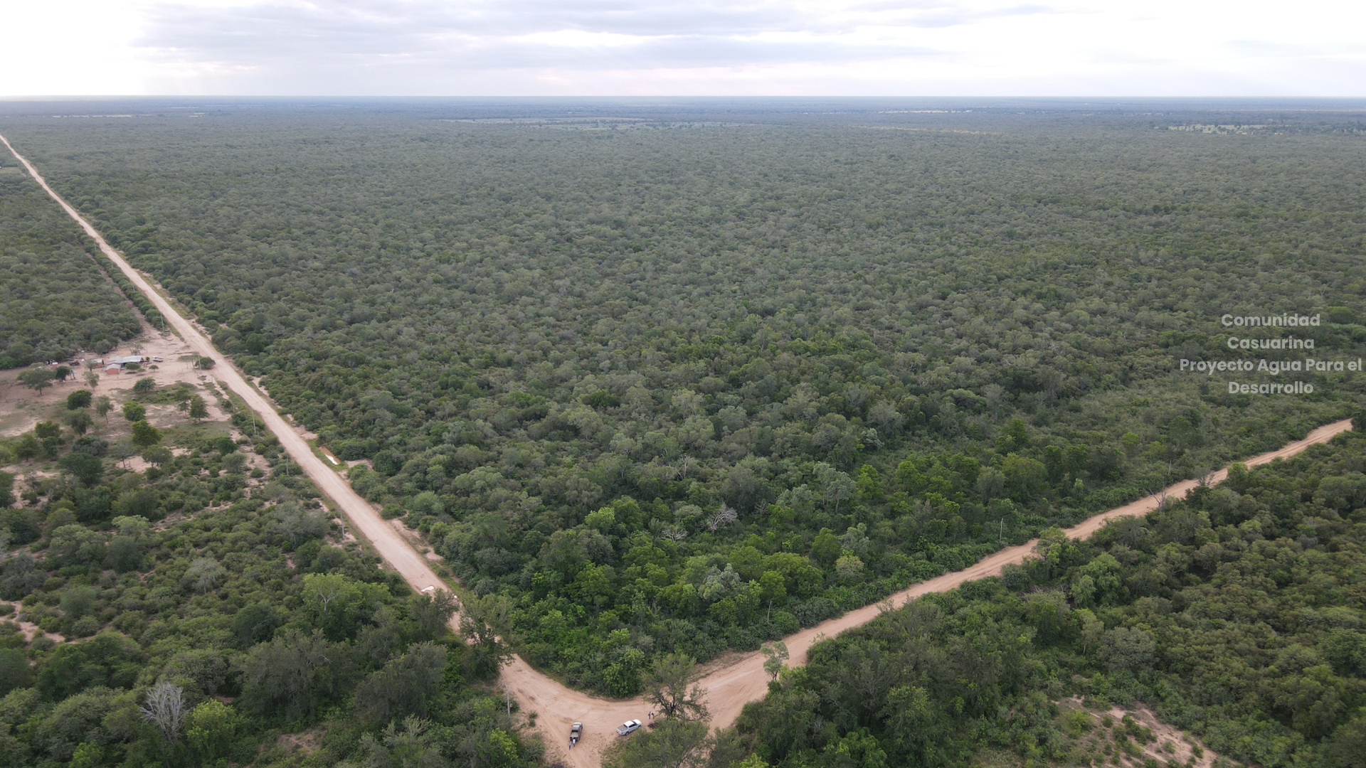
Process for identifying potential areas
Areas within the territory were assessed taking into account biodiversity, threats and customary use. Community-led monitoring, based on ongoing observation, was supplemented with scientific data and indicators on biodiversity, zoning, forest cover, soil quality and habitat, thereby strengthening the monitoring required for forest certification and its integration into payments for environmental services.
The following areas were identified:
Western Zone: a hinterland area with palaeo-riverbeds and riverbeds, prone to forest fires.
South-Western Zone: a forested area with palo santo, quebracho (an endangered species of great economic and cultural value) and coronillo forests. Intrusions by outsiders for illegal logging and charcoal production were detected. Thanks to community monitoring, the intruders were successfully expelled. Furthermore, it is an important area for beekeeping, which serves as a source of income for the community.
South-Central Zone: predominantly espartillar (70%), with lower forest cover. It has been affected by aerial spraying and is highly vulnerable to degradation. It is also important for agriculture. This area serves as a reserve for both subsistence and income-generating farming by the community
Community centre: the main settlement, characterised by shrubs and sparse trees; an easily accessible area subject to firewood collection by people from outside the community. It is not considered wooded, but there is a mix of trees and shrubs.
Eastern Zone: an area with a diverse range of tree species, including carob trees – a staple food source for the Nivaclé people – which is difficult to access, thereby aiding its conservation.
Extended Eastern Zone: covering some 1,500 hectares of diverse species such as carob, prickly pears, docas, sacha, forest watermelon and wild beans (part of the Nivaclé food system); as well as espartillar, quebracho and palo santo (an endangered species). There is a presence of wildlife (birds, deer, tapirs, wild pigs) as well as an abundance of wild fruits with limited access, which is seen as an advantage for conservation. This zone was considered the most suitable for certification.
This decision was preceded by a participatory process that included free, prior and informed consultation with the community (FPIC), with the participation of technical experts (biologists, forestry engineers, indigenous technicians) and the involvement of the entire community.
Community governance is based on the key participation of:
- Elders, including men and women with spiritual leadership
- The community council, made up of representatives from the villages
- The technical team: comprising indigenous and non-indigenous professionals
- The women’s committee: with formal representation recognised by the council and the technical team.
It is worth noting that the role of women is fundamental, not only because of their leadership in decision-making (even when this is not formal), but also because they form part of the internal family consensus-building processes. Similarly, traditional food practices, knowledge of traditional medicine and craftsmanship – which have traditionally been in the hands of women – are being revalued.
Results and challenges
The community has 1,500 hectares certified as priority areas for conservation, out of a total of more than 7,859 hectares, where it carries out sustainable production practices such as subsistence and cash farming, and the harvesting of non-timber forest products, without the intensive use of agrochemicals or extensive forest conversion. However, the challenge remains of identifying and finding buyers and securing payments for the environmental services provided by their certified forests.
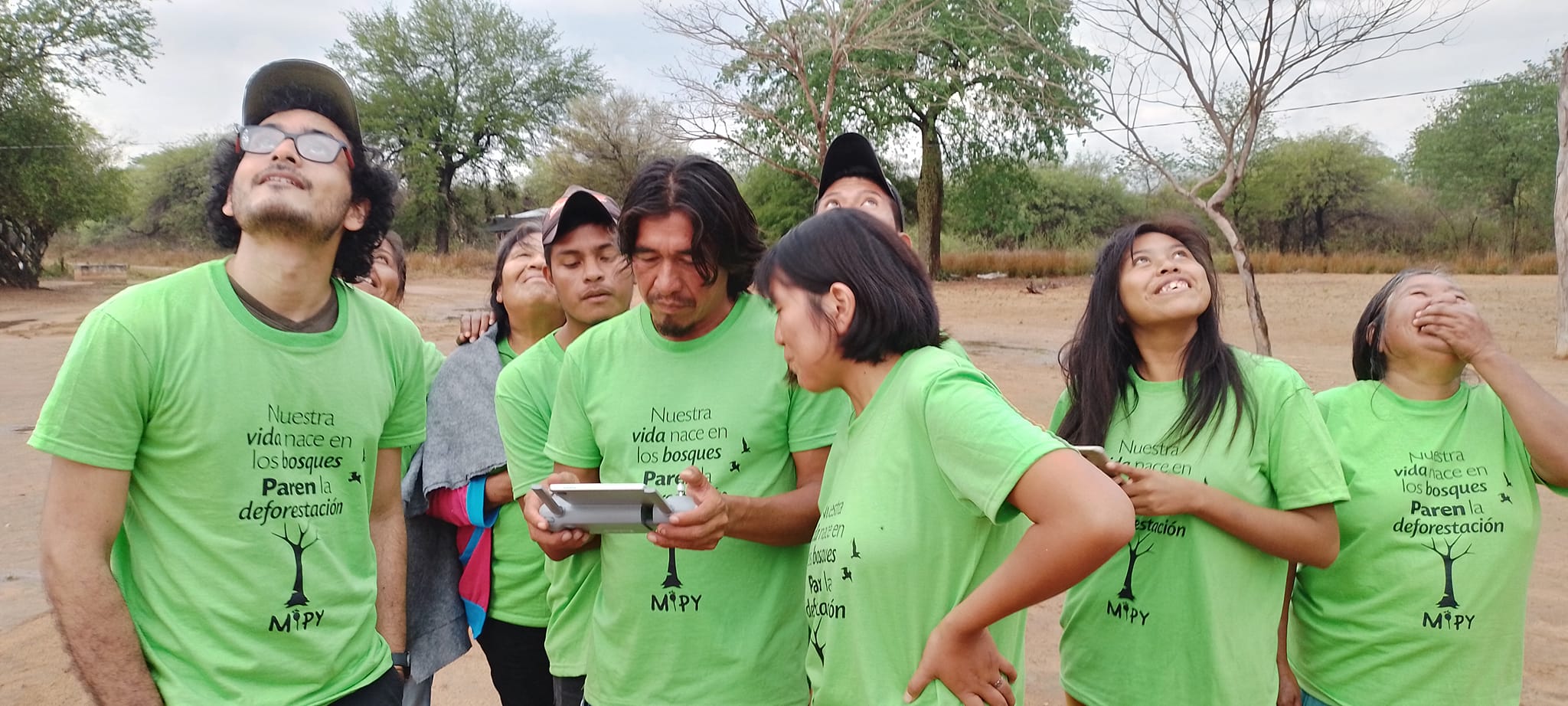
Progress is being made in the gradual incorporation of technologies adapted to the cultural context for territorial and forest monitoring, with the active participation of trained young people and women, including the use of drones to monitor illegal activities (logging and charcoal production), changes in forest cover, wildlife and unauthorised access.
The community organisation has been strengthened; it manages its financial and human resources and coordinates with public and private institutions. However, there is a need to continue consolidating governance by updating internal regulations, defining clear roles and establishing control and sanction mechanisms to address the misuse of resources.
Lessons learnt
- Community participation is key to ownership, control and sustainability
- Ancestral knowledge strengthens environmental management and forest conservation
- Women play a central role in community governance
- Forest certification can be a strategic tool for territorial defence and forest conservation
Contributions to the Kunming–Montreal Global Biodiversity Framework and the Convention on Biological Diversity
This initiative contributes directly to:
- Target 1: plan and manage all areas to reduce biodiversity loss
- Target 3: conserve 30 per cent of land, inland waters and marine areas
- Target 5: ensure that the collection and trade of wildlife are sustainable, safe and lawful
- Target 9: sustainable management of wildlife for the benefit of people
- Target 10: improve biodiversity and sustainability in agriculture, aquaculture, fisheries and forestry
- Target 21: ensure the availability and accessibility of knowledge to guide action on biodiversity
- Target 22: ensure the participation of all in decision-making and access to justice and information relating to biodiversity
- Article 8(j): protection, respect and use of the traditional knowledge of Indigenous women.