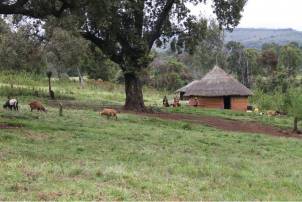

The Ogiek of Chepkitale are Indigenous hunter-gatherer people of Mt. Elgon in western Kenya, living across present-day Trans Nzoia and Bungoma counties. They occupy the dense forest area, open glades and the moorlands extending to the peak of Mt. Elgon, bordering Uganda to the Northwest. For the Ogiek, this is an ancestral territory inherited through generations.
Families trace their ancestry, relationships and belongings through clans, rivers, caves, grazing grounds and beehive zones found within the three sub-nations of Kaabeeywa, Chebookoos and Kebereer. Ogiek’s livelihoods depend directly on the health of the ecosystem. Honey harvesting, seasonal grazing, collection of medicinal plants, bamboo use and small-scale forest products such as vegetables, follow Ogiek customary by-laws. The land is also spiritual; certain hills, caves, trees and rivers are respected as places of prayer and community rituals. The Council of Elders through Chepkitale Ogiek Governing Council guide decision-making, while the women’s association (Teryeet Women Association-TERWA) ensures women’s voices are included in discussions on resource use and tenure rights.
For many years, external management systems around Mt. Elgon have been carrying out conservation without recognition of the Ogiek traditional practices. The systems monitor wildlife and forest conditions, but they do not always observe local changes. These systems of monitoring lack sensitivity and wisdom from day-to-day life embedded in interactions with ecosystem processes.
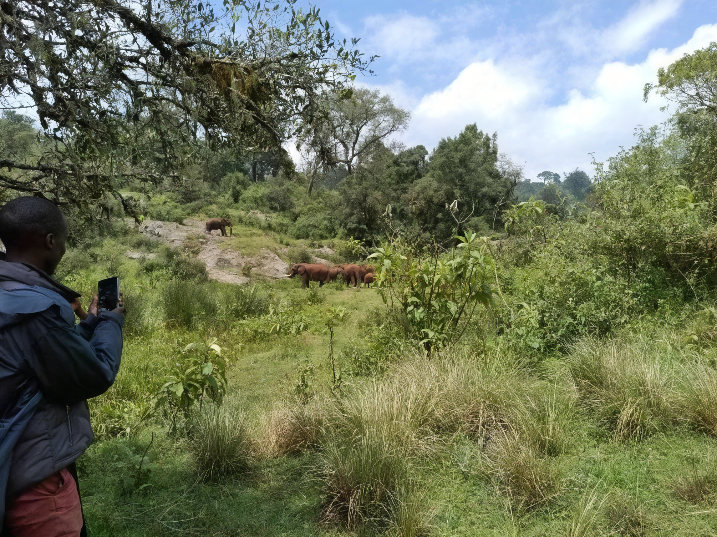
On the other hand, the community observes these changes during their daily activities and has great knowledge of them, and awareness of their importance; for example, shifts in grazing patterns, early signs of forest fire, decline of certain flora and fauna, or movement of wild animals around salt lick points.
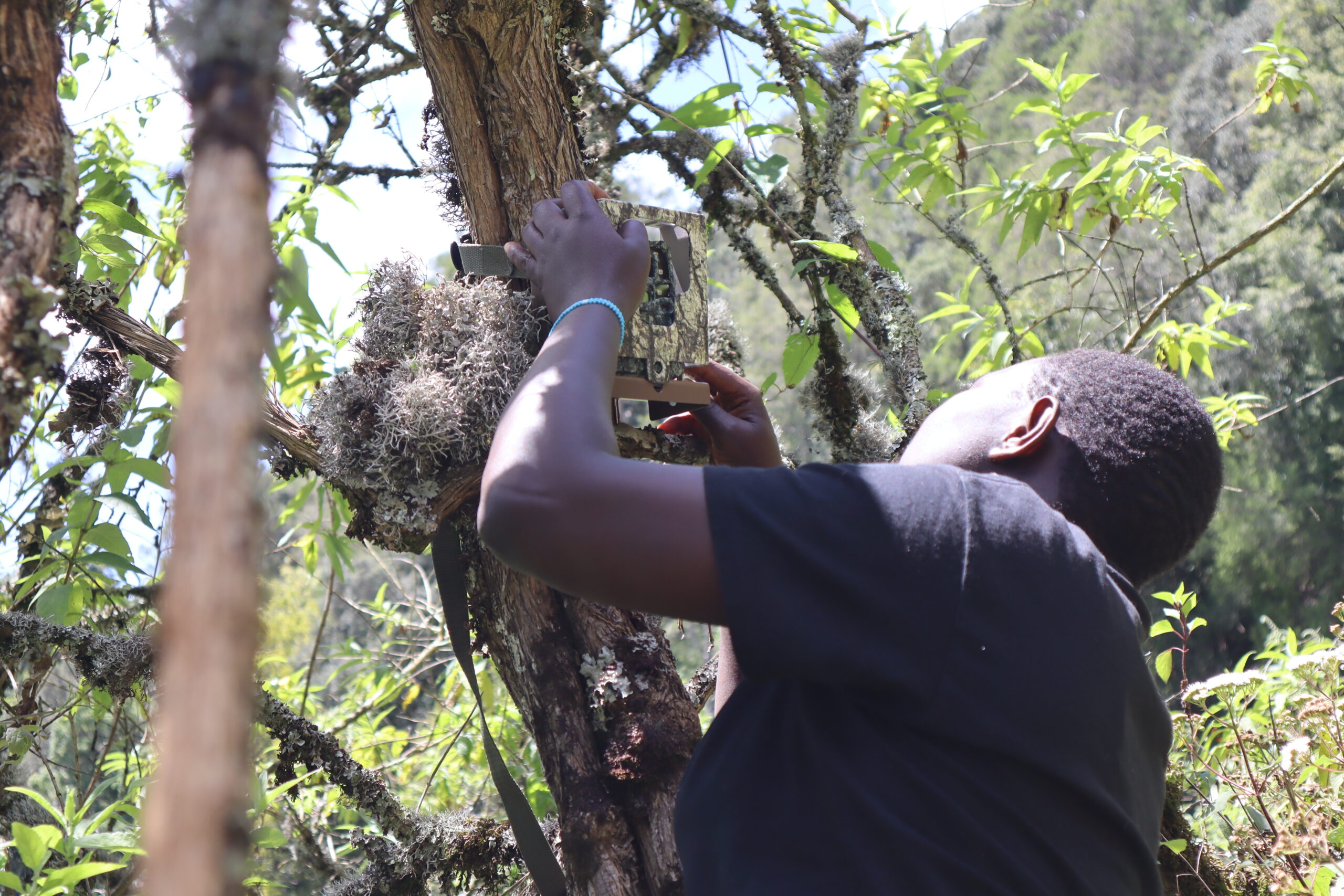
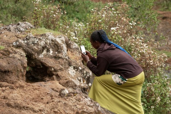
Image: Ogiek youth /CIPDP staff mounting camera trap near Lolwoot cave, an area rich in salt licks and prone to elephants. Credit: CIPDP
Community monitoring: combining traditional knowledge with scientific tools
The Ogiek people of Chepkitale continue to demonstrate what Indigenous stewardship of biodiversity looks like in practice. Through the Transformative Pathways project, the Ogiek have developed a participatory Community-Led Biodiversity monitoring system that combines traditional ecological knowledge with modern scientific tools to demonstrate the effectiveness and rationale of their stewardship.
Monitoring therefore becomes necessary for two reasons. Internally, to guide decision making and sustainable use of local resources. Externally, to show conservation authorities and other stakeholders that the Ogiek traditional knowledge system of conservation remains active and effective. The community holds that conservation can succeed with application of their traditional knowledge and practices.
The decision to begin biodiversity monitoring came through community discussions led by the Council of Elders. Meetings were held in villages across Chepkitale to agree on what should be observed and who should take responsibility. The elders emphasised that monitoring should follow customary priorities: bamboo areas, medicinal plants, wild animals’ paths, salt licks, snares and fire-prone zones.
The community first relied on its traditional practices where youth, women and elders in their daily chores observe and track changes, animal signs, and share back as oral reports. Later, with technical support from partner organisations – Forest Peoples Programme and the Inter-disciplinary Centre for Conservation Science – who suggested and offered training on the tools that would be used to supplement Ogiek practices in biodiversity management.
With community consultations, three methods of data collection were agreed upon; Camera traps placed in agreed locations, line transects that followed predetermined routes, and quadrats to observe bamboo health.
The mobile app CoMapeo was preferred as the principal data collection tool for several reasons. The Ogiek of Mount Elgon had been, and continue to be, closely involved in its ongoing codesign with the developers Awana Digital, and it incorporated features they requested and needed for the monitoring, such as recording of audio and tracks. It was also developed to be very customisable, translating local languages and easy to use. Critically for the Ogiek, it also allows for complete data sovereignty, meaning that the community remains in control of the data and can choose when and with whom to share it. The Ogiek are using CoMapeo alongside the platform Guardian Connector, another open-source tool built by Conservation Metrics International with Indigenous data sovereignty principles at its heart. Guardian Connector allows them to view all their monitoring data, including camera trap images, and carry out analyses themselves.
Monitoring is organised around community roles. Youth conduct field walks, check camera traps and record animal tracks, grazing conditions and water sources. Women monitor bamboo stands and collect information about plant health and usability. Elders help youths to interpret findings and connect them to seasonal cycles and customary rules, hence supporting intergenerational knowledge transfer. Observations include elephants and other wildlife presence, bamboo health, illegal activities in the resources accessed by people outside Ogiek community and medicinal plants.
Information is reviewed in meetings where data from transects, quadrats and camera traps are discussed. If a grazing area shows signs of stress, access may be temporarily restricted. If bamboo regeneration is weak, harvesting is delayed. When wildlife corridors are identified, grazing routes are adjusted to avoid disturbance. Decisions are therefore practical and immediate. Monitoring does not end in reports; it leads to actions agreed by the community and communicated to conservation authorities when necessary.
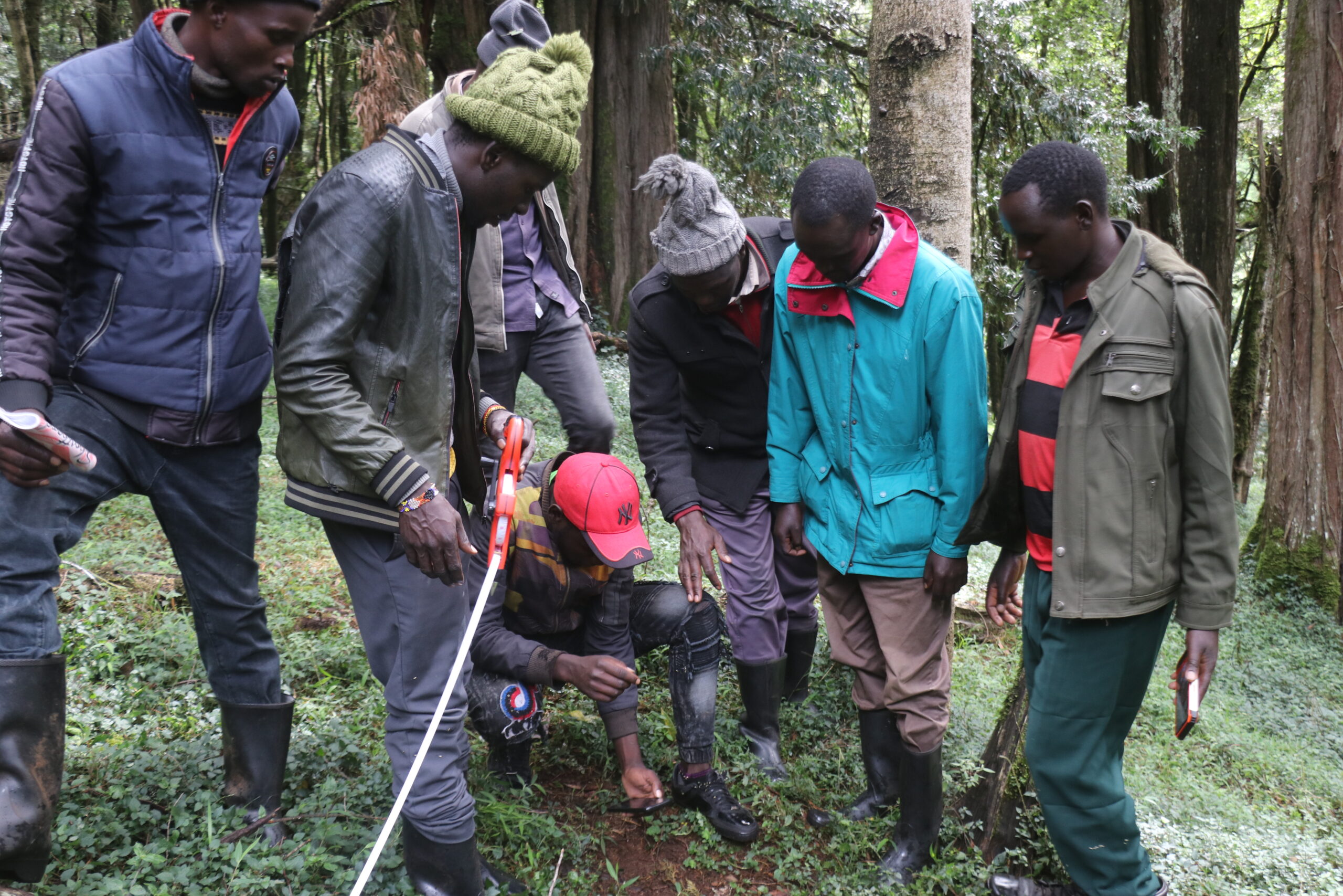
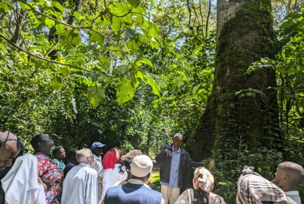
Image: Ogiek monitors during line transect biodiversity monitoring. Credit: CIPDP
Results and reflections from community monitoring initiatives
Several changes have followed the monitoring initiative.
Ecological outcomes: wildlife movement areas are being better understood, old species that were believed to be extinct are still available as evidenced by camera trap photos. The community has now started discussions on the expansion of a wildlife corridor, as well as collaborating with Kenya Wildlife Services (KWS) on the development of a comprehensive Mt. Elgon Biodiversity Inventory. The community now tracks seasonal variation and adapts grazing accordingly.
Governance outcomes: customary institutions have become more active because information is discussed collectively. Dialogue with Kenya Wildlife Service (KWS) and Kenya Forest Service (KFS) has improved, as the community can present clear evidence of stewardship. Decisions are negotiated rather than imposed, as evidenced by ongoing conversations with Ogiek to help monitor biodiversity inside Mt Elgon national park.
Social and cultural outcomes: youth participation has increased respect for elders’ knowledge. Women have gained stronger roles in land discussions through bamboo monitoring. Knowledge once shared only orally is now reinforced through observation and teaching. Children learn why certain areas are protected, strengthening cultural continuity. Monitoring has therefore strengthened the inter-generational knowledge transmission.
Experience has shown that conservation works best when communities design monitoring themselves. Indigenous knowledge helps identify important ecological areas that outside surveys may overlook. Participation must involve real decision-making, not consultation alone.
Data ownership is also important. When communities trust how information is handled, they are willing to share it. Monitoring encourages responsibility: people care more for what they observe directly.
Another lesson is that scientific tools are useful when they follow community priorities. Technology alone does not conserve nature; relationships do. The monitoring process strengthened cooperation between generations and built confidence between the community and conservation agencies.
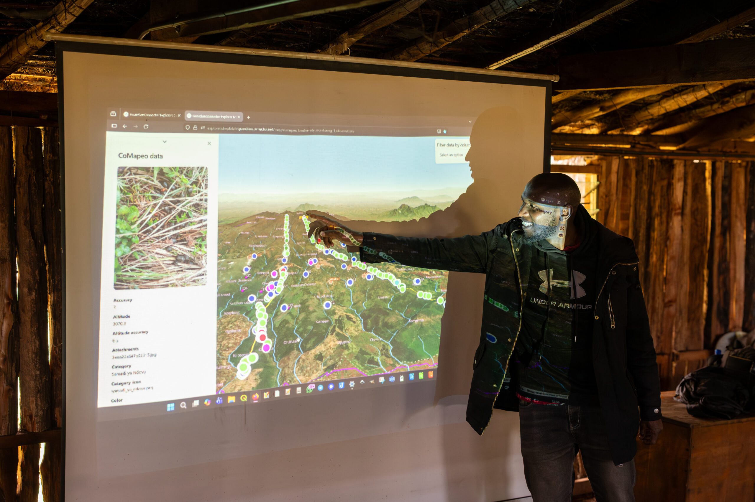
Image: CIPDP staff explore monitoring data with Ogiek community members. Credit: Rudo Kemper
Links to the Global Biodiversity Framework
This initiative contributes to several global biodiversity goals. Community mapping and biodiversity monitoring help identify important areas for conservation (Target 1). Sustainable grazing and bamboo management support ecosystem integrity (Target 2). Indigenous stewardship demonstrates effective conservation within traditional territories (Target 3). Recording wildlife presence contributes to species protection (Target 4).
The process is participatory and inclusive, involving elders, youth and women in decision-making (Target 22), while strengthening the role of women’s groups and young people in conservation leadership (Target 23). Together, these actions show how local governance can support international biodiversity commitments.
The Chepkitale Ogiek experience suggests that conservation policies should recognise Indigenous governance systems as partners. Supporting such systems can strengthen biodiversity protection while respecting human rights. The future of the mountain, and of many similar landscapes, depends on working with the people who know them best.