

Besao is a municipality in Mountain Province, in the Cordillera region of northern Luzon in the Philippines. It is a 5th-class municipality with a population of 6,315 people (2024 census) and a total land area of 173.62 square kilometres, characterised by sloping, mountainous terrain.
The main livelihood in Besao is rice farming on payew (terraced wetlands or paddy fields) and swidden farming on uma/um-a (rotational farms). Diverse crops such as sweet potato, corn, legumes, squash, and sugarcane are planted in these areas. Temperate fruit trees, as well as other root crops and vegetables, are also grown for household consumption. Livestock and poultry are typically raised in residential backyards. In recent years, vegetable gardens have been established in formerly forested lands, where temperate vegetables are cultivated for commercial purposes.
The Kankanaey people of Besao have long safeguarded their lands through Indigenous resource management systems. An example of this is the Batangan system of pine forest management, wherein community members follow a traditional set of rules governing the use, distribution, and sharing of resources within a designated area. This practice has helped maintain the dense pine forests spread across the municipality.
However, today, several factors have hastened the loss of land and water resources. Climate change has resulted in more recent forest fires, damaging the forests. The need to expand agriculture to support a growing population has also led to encroachment into forests and pollution of land and water caused by pesticide use.
These changes underscore the importance of updating the Ancestral Domain Sustainable Development and Protection Plan (ADSDPP) of Besao to tackle current challenges and find effective ways to continue safeguarding the community.
Land use mapping of Besao’s ancestral domains
In response, the Indigenous Peoples’ Mandatory Representatives (IPMR) of Besao partnered with Partners for Indigenous Knowledge Philippines (PIKP) to conduct land-use mapping of Besao’s four ancestral domains. The four ancestral domains in Besao are:
- Payew, which is composed of barangays (village ward) Kin-iway, Padangaan and Payeo (KinPadPay)
- Besao, composed of barangays Besao East, Besao West, Banggitan and Sukib (BeBaSu)
- Agawa, composed of barangays Lacmaan, Agawa, Gueday, Ambagiw (LAGA) and
- Kinali, composed of barangays Tambuan, Laylaya and Catengngan (TaLayCa).
The results of the community mapping could serve as additional input for updating the ADSDPP and other development plans of Besao.
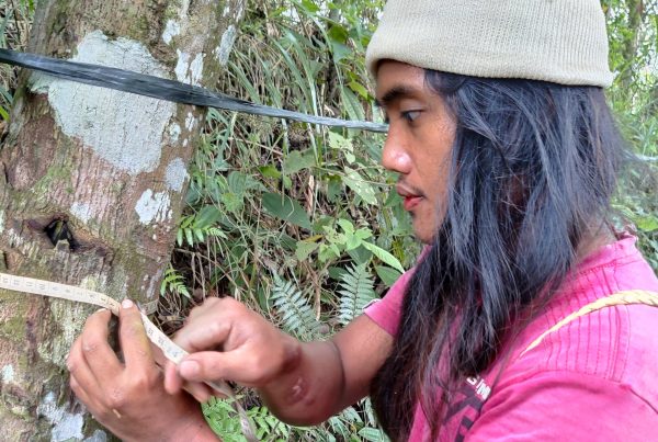
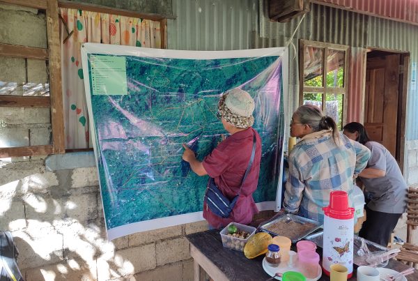
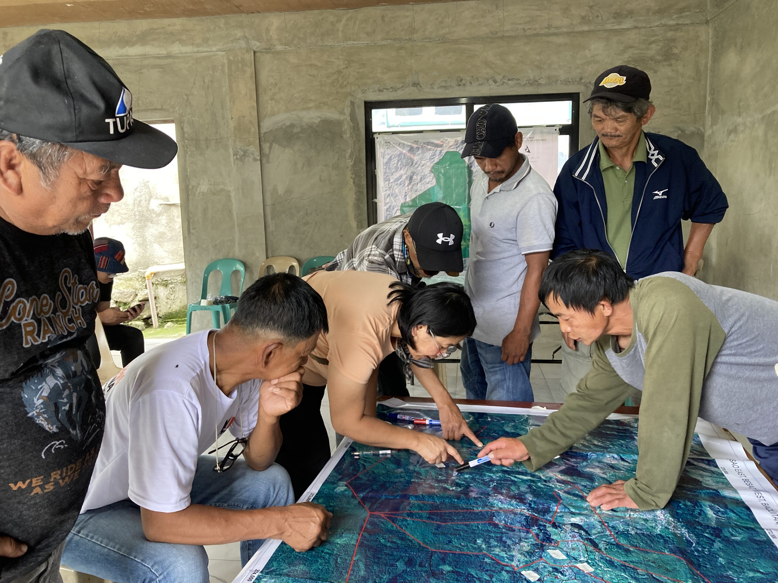
The process began with community representatives defining the boundaries of each of the four ancestral domains. Separate maps for each domain were then created. A series of community-based workshops followed, during which community members identified and marked land uses on the provided base maps. They also mapped other important community sites, including water sources, churches, schools, and culturally significant locations.
Lakay Pagatic, IPMR of Payeo village shared some insights about the mapping process:
“Idi damo, narigatan kami ta sabali gayam ti itsura ti ili na maikarga iti mapa. Ngem inot-inot met nga naawatan mi enggana nakumpleto tayo ti mapa. Mayat ta step by step ti inkasta. Makatulong daytoy mapping karo kadagitoy ubing tapno mas maawatan da pa ti ili.”
“At first, we had a hard time because the community looks different when it is placed on a map. But slowly, we were able to understand the process until we completed the map. It was good that the mapping was done step by step. This mapping activity is very helpful, especially for the youth so they can better understand their community.”
Participatory mapping is a valuable tool that helps communities better understand their local environment. Maps can visually depict land uses within a community and illustrate how different land uses interact and potentially cause environmental harm.
The results of the community workshops were digitised into land-use maps and returned to the communities for feedback and validation. Once finalised, the maps were presented at a municipal-level forum attended by community representatives, municipal officials, and members of the National Commission on Indigenous Peoples (NCIP).
In this forum, participants shared insights from the mapping activities and discussed how the maps can be used to better manage and protect municipal territories and reduce biodiversity loss. A community elder from Tamboan village explained:
“Maipakita ditoy mapa dagiti importante nga lugar iti ili tayo kas water sources nga kasapulan nga aywanan. Usaren mi daytoy mapa tapno maimprove ti plano ti barangay.”
“The maps show important areas within our community, such as water sources that need to be protected. We will use the maps to improve the plans of our village.”
Key findings
Initial analysis of the mapping results has provided important insights into Besao’s land use. A total of 9,367 hectares, or 51 percent of the municipality’s land area, are classified as pine forest and managed under the Batangan system. Community members are allowed to access and use resources within these forests based on a traditional set of rules.
Another key finding is that 6,735 hectares, or 37% of the land area, are designated as Indigenous and Community Conserved Areas (ICCAs): territories, ecosystems, and natural spaces that are voluntarily governed, managed, and conserved by Indigenous Peoples and local communities. In Besao, these ICCAs include watersheds and forested areas where biodiversity is high. Livelihood activities are not allowed, and access is restricted in these areas.
The maps also show that 1,022 hectares are devoted to rice fields, which shows a decrease from previous years because many rice fields are now being abandoned. One reason behind the abandonment of rice fields is that some people in the community prefer to engage in less labour-intensive sources of income such as buying and selling of goods or employment in local offices, among others. The youth are also moving to the cities to study and work, so there are less people left to continue rice farming. There is also an observable reduction in water supply that is needed for irrigation in rice cultivation. These issues were identified in the process of mapping, and the community expressed the need to address these concerns. Other important sites identified in the ancestral domain land use maps include sacred community areas, burial grounds, rivers and streams, and residential zones.
The land-use mapping was conducted through a participatory process wherein efforts were made to ensure that representatives from various community sectors – including women, youth, and elders – were present in each workshop. Each participant was encouraged to share their insights. Discussions on land use, environment, and agriculture were carefully documented and submitted alongside the maps to provide additional context and information.
Besao Vice mayor Elizabeth Buyagan stated:
“Usaren tayo dagitoy mapa tapno mas maawatan tayo ti kasasaad ti ili tayo. Aywanan tayo ti land and resources tayo para iti aanak, aapo ken para iti sumarsaruno a henerasyon.”
“Let us use these maps to better understand the situation of our communities. We should protect our land and resources for our children, grandchildren, and future generations.”
Living close to the land, the Indigenous People of Besao have a deepened understanding of their community’s situation and have gained knowledge to protect their community. Building their capacity with new tools, such as land-use mapping, strengthens their existing traditional practices and can help them plan better initiatives to safeguard their community.