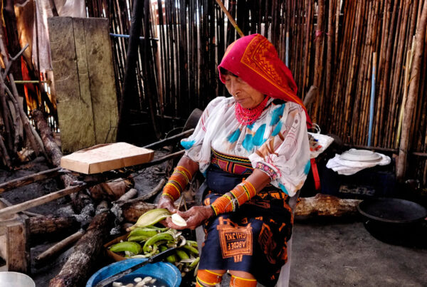

The Gunayala Comarca is one of the seven indigenous Comarcas in the Republic of Panama. It constitutes a political division whose organisation, administration and operation are governed by a special legal framework, as set out in Law 20 of 31 January 1957 and the Comarca Statute.
The Panamanian Government recognises the Guna people’s right to their lands and to indigenous self-governance. As a result, the Kuna Yala indigenous region now enjoys an autonomous administrative system.
The Gunayala region covers an area of 7,513 km², comprising the mainland (2,441 km²) and the maritime area (5,072 km²), and stretches for over 320 km² (Madrigal, 2000). Its width varies between 10 and 20 km. The average annual temperature (24°C) in the highland areas of the mainland is 20°C, whilst in coastal areas it is 26–27°C. Average annual rainfall varies depending on altitude, ranging from 2,600 to 4,000 mm. The months with the highest rainfall are May to December, with rainfall decreasing during the summer months (January–April).
The region’s relative geographical isolation has meant that the Gunas have managed their natural environment in accordance with their cultural practices and experiences. According to Guna customs Igardummad Uala: natural resources, both renewable and non-renewable, and all their biodiversity, form part of the heritage of the Guna people; and as such, it is the responsibility of the Guna to seek ways to restore, rationally use, conserve and utilise these resources through their General Congresses and internal administrative systems.
Management of marine ecosystems
Indigenous Peoples have developed systems for managing ecosystems and administering natural areas. These systems are based on the worldview, customary laws, and cultural and spiritual values of Indigenous Peoples; they have proven to be effective for the conservation of resources and ecosystems, as well as for the sustainable use of biodiversity.
Unlike the Western view of nature, which tends to regard marine ecosystems as a productive resource of heritage value, for Indigenous Peoples the sea and the territory as a whole have primarily a cultural value, forming part of something greater and more powerful, with sacred attributes. Spirituality cannot be separated from the biological realm, as various rituals are performed to facilitate biological processes and resources are utilised whilst invoking the gods. Within this context, ‘territory’ is defined from a holistic perspective that includes not only the productive functions of the land but also a range of constituent elements such as forests, marine and coastal waters, mountains, savannahs, deserts, the subsoil and even the landscape, which together form a unique system intimately linked to concepts such as: community, spirituality, culture, ecology, time and others.
The cultural, spiritual and environmental significance of the Birias to the Gunas
The concept of Biria
In Guna society, ‘biria’ refers to the sacred area or habitat of certain species of fish, molluscs, crustaceans, turtles and marine resources, which must not be altered from their natural state, as this would bring calamities upon the communities living near these sites.
More generally, we can say that it represents “the abode of the forces of nature and is vital to the elements of nature, including humans; indeed, its importance is such that the Gunas believe they would cease to exist without it”.
The main function of these areas is to provide a habitat or breeding ground for various species of fish, crustaceans and other organisms in bodies of water. In other words, they form part of this town’s natural resource management. These sites are usually breeding or rearing grounds for endangered species.
Disrupting these ecosystems has an impact on marine biodiversity and on the way of life of the Guna people, who depend directly on marine resources for their food security.
There is no doubt that this respect for sacred sites has enabled Gunayala to become one of the best-preserved places in the Republic of Panama. We can regard this as effective management of its natural resources, based on traditional environmental stewardship, which shows us that when a community is involved in the management of its resources, that management is more effective.
The Birias have made a significant contribution to the conservation of biodiversity in particular, although there are other ecosystems outside the Birias that have also played a role in conservation, such as mangrove ecosystems, forests and others.
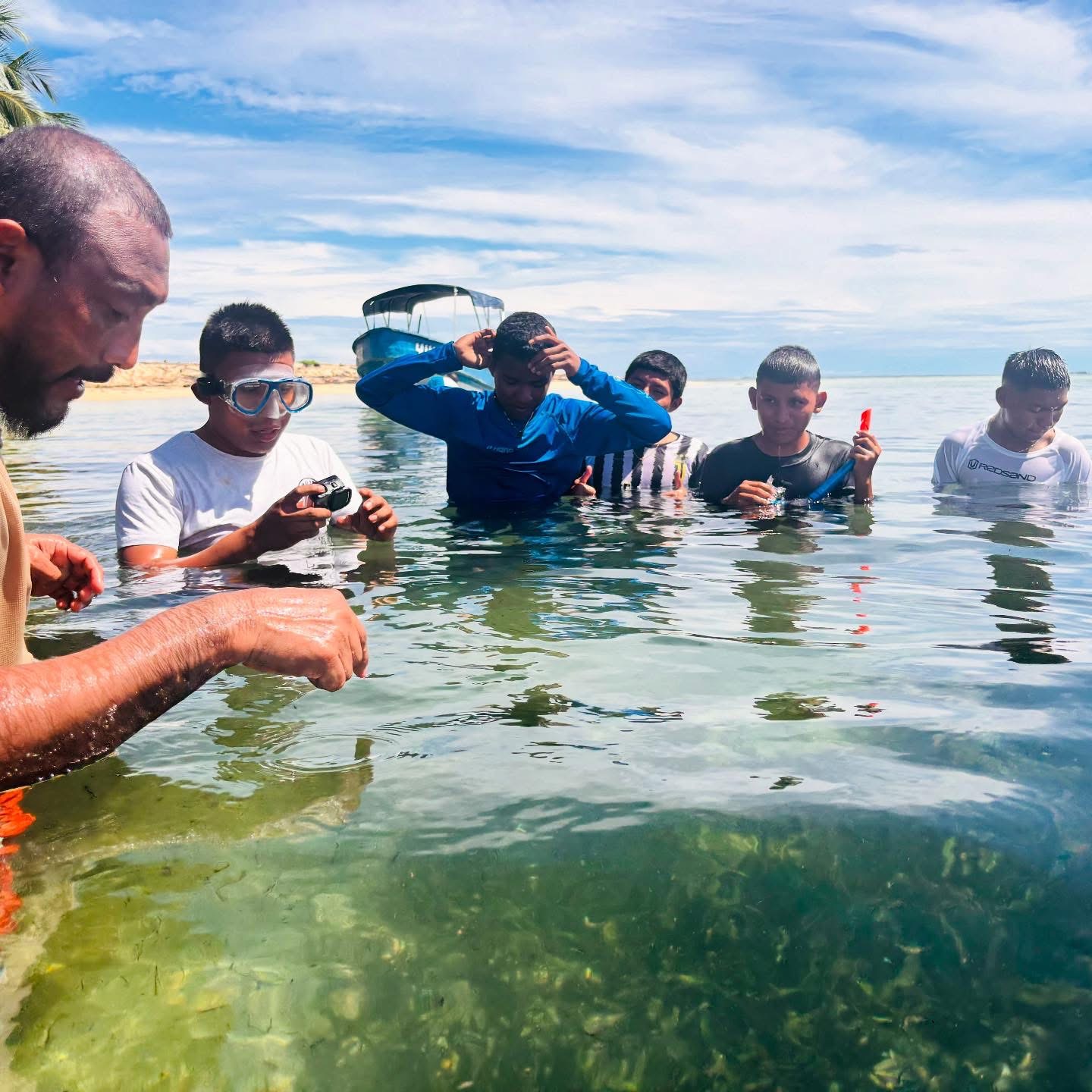
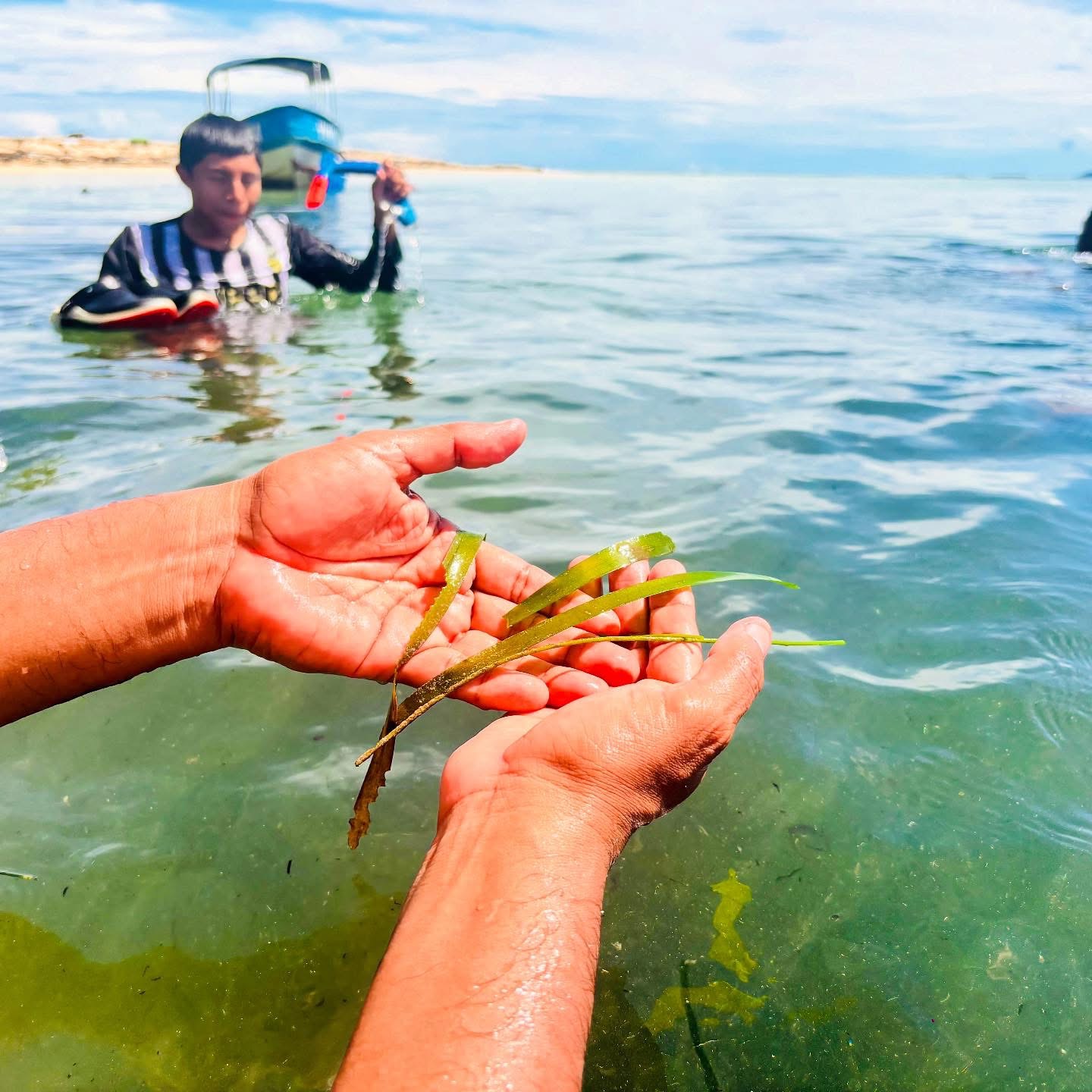
Caption: Identificacion de arrecifes corales. Credit: Yadibaler Lopez
Objective
To describe the reef system in the Gaigordub area and the existing spatial management practices there, as well as the environmental threats observed, in the Gunayala region, Republic of Panama.
Methodology
An integrative methodology was applied in carrying out this study, consisting of combining various approaches to the human-environment relationship within Physical Geography, indigenous knowledge, GIS, remote sensing and Sociology, amongst others.
Cartographic sources, aerial photographs and satellite images
- Cartographic sources: all were scanned at a high resolution (300 dpi) and subsequently georeferenced
- Aerial photographs.
Analysis
Within the marine-coastal system, two areas or zones of activity can be distinguished: the di dinagan (shallow waters) and the uila arad (deep waters). The first of these refers to the shallow coastal strip where fishing activity is intense; some of its characteristic features include: the ailimar (mangrove forest), los di gagan (seagrass beds), aggua dingan (coral reefs), etc.
For their part, the uila arad (deep waters) represent areas with depths of more than 50 metres and extensive fishing activity; these are poorly studied and very little used areas.
To this end, the reefs located within the study area were mapped at a scale of 1:50,000.
Until the body is nothing but fear, the author of the fringilla. No one needs a laugh to adorn a soft urn or to be a lion. Until the body is nothing but fear, the author of the fringilla. Nothing in life is more liberating than freedom, and the pharetra is augue. When the associates, the newborns, the householders and the great gods bring forth mountains, a ridiculous mouse will be born. Let us live: the arrows are blue or brown, the rutrum is at the throat, and the pain is the author.
It was entirely intact before being poisoned by those foods; it would still want to be poisoned, albeit with a slight twist. The author of the ullamcorper is not null but rather non-metus, and the fringilla. Maecenas, however, is diam and risus, the variable of the blandit, and it is not magna. The author of the ullamcorper is not null but rather non-metus, and the fringilla. Nulla vitae elit libero, a pharetra augue. Aenean lacinia bibendum nulla sed consectetur.
Results: management and use of natural marine and coastal systems
Like inland systems, the region’s marine and coastal systems are used extensively. The Gunas obtain the vast majority of their animal protein from these systems. As regards environmental management tools, there are generally spiritual management practices that influence models of marine and coastal use and management; taboos, stories, narratives and songs are some of these elements. However, they have been little studied or documented.
According to the oral history of the Guna people, everything we now know as marine species used to be human beings; they all had their own names, such as Olobiskaliler, Olonaidiginya, until it appeared Ibeler who, when founding the inna nega (the chicha bar) got all those people drunk, and they subsequently turned into animals, which is why Olobiskaliler Today is Dulub (lobster) and Olonaidiginya is Nali (Shark). For this reason, many of the Gunas’ traditional maritime practices and customs prohibit the consumption of some of these animals.
Another important aspect regarding marine and coastal use and management within the region is the influence that the area’s geomorphology has on, or exerts upon, the stability of its systems, the type of management practised, and traditional indigenous uses.
Generally, accessibility will depend on the depth and the distance between the areas. Areas closest to communities or settlements will be much more likely to be used or managed; shallower zones will be much more heavily managed and used, with those less than ten metres (10 m) deep constituting areas of intense activity, whilst zones deeper than ten metres (-10 m) will be moderately vulnerable to being used or managed.
For example, lobster fishing in the region is carried out exclusively using free-diving (apnoea). The use of scuba gear or any other sophisticated fishing techniques that endanger the region’s marine resources is prohibited. This prohibition is laid down in the Gunayala Region’s Statute, which is why no lobster fishing or other fishing activities involving diving to depths greater than 25 metres are carried out.
Areas with a depth of more than twenty-five metres (-25 m) are classified as low-vulnerability areas. They are characterised by low levels of human activity, with traditional fishing and transport being the most common activities.
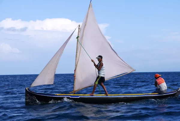
Environmental conditions such as wind and sea currents are other important factors in the potential management and use of natural systems; areas with favourable conditions facilitate access to and the potential use of these systems for a particular action or activity. In Gunayala, wind and currents are utilised as key means of transport.
The reef systems studied
According to a study carried out in 2002 by Dr Héctor Guzmán of the Smithsonian Tropical Research Institute (STRI), the Gunayala region is home to the greatest diversity of coral species and the best-developed reefs in the Republic of Panama. It is also considered one of the best-conserved areas within the Tropical North-West Atlantic Coastal Biogeographical Province; however, preliminary scientific data also show a 72 per cent decline in live coral cover between 1983 and 1997 (Guzmán et al., 2002).
This study warns that the area of reefs in the region may be less than 191 km² (based on coral cover alone) and that their vitality is estimated at just 24 per cent.
Despite this, the reefs of the Gunayala region continue to harbour the highest biodiversity in the Panamanian Caribbean, with 69 species of coral, 38 octocorals and 84 sponges. Furthermore, high coral cover generally correlated with greater diversity of corals, octocorals and sponges; however, it is important to note that a direct relationship was found between live coral cover and distance from the coast, indicating greater reef degradation in areas close to communities (Guzmán et al, 2002).
The Gunayala reefs with the greatest diversity were recorded in the district of Narganá, the area where our study site is located. The lowest diversity of corals is found in the eastern part of the Gunayala Comarca, known as the district of Dubwala.
The area selected for the study features a fringing reef system; in its easternmost part, it exhibits a bank reef structure, as indicated by its geomorphological analysis.
Fringing reef
This reef forms close to the coast and consists of both functional and non-functional boat channels (0.06 km²) and a beach ridge (0.94 km²). It covers an area of 20.05 km². Towards the east, this type of reef transitions into a bank reef.
A map on a scale of 1:50,000 has been produced, focusing on geomorphological and biosedimentary interpretation, along with two transects across the fringing reef in the northern part of the Kuna Yala Peninsula, running in a SW–NE direction, to characterise it from a biosedimentary and geomorphological perspective based on the recorded bathymetric data.
In view of the results, the first transect reveals an extensive fringing reef system, approximately 8 km long and with a depth greater than -45 m. The most prominent feature within the environmental unit is the beach and reef sand gravel, in addition to the presence of a 70-metre-long silted-up navigation channel, or ‘boat channel’, with depths ranging from 0 to –3 m, known as an ‘incipient boat channel’ (Guilcher, 1988).
We would like to emphasise that, from a management perspective, this route is the most important one for producers travelling to and from their farms.
Another notable feature within this same reef system is the coral colonies forming from a depth of -20 metres and the deep channels developing from a depth of -25 metres. These act as important barriers in this part of the region, thereby preventing beach retreat and erosion.
The second transect reveals a much deeper and shallower system of gravel and sand (approx. 25 m), but with a highly developed coral accretion system 60 metres in length, featuring seagrass beds composed of Thalasia testudinum and Syringodium filiforme. A channel system is also visible from -15 m downwards, and a large reef flat (approx. 2.5 km) at a depth of -20 metres.
Overall, this system appears to be a barrier reef unit with an emerging boat channel, but it possesses very significant ecological characteristics that make it a highly active and productive system.
Several species of fish, crustaceans and molluscs were observed there, mostly at the larval and juvenile stages. In areas closer to the coast, new colonies of hard and soft corals were observed. In shallow waters, the natural repopulation and colonisation of new areas by red mangroves was also observed.
A shoal reef and its components
This environmental unit is generally characterised by being much shallower than the previous ones. In this unit, sand deposits are not only found in the beach systems (-3 m) but are also deposited in areas much further away known as lagoons, which are characterised by being calm and generally shallow. To facilitate a better understanding of this type of reef system, a map has been drawn up and two transects have been carried out.
The transepts of this reef system are characterised by highly developed areas of reef accretion and functional navigation channels – or ‘Boat Channels’ – which reach a depth of -7 m, whilst the lagoon reaches a maximum depth of -15 m, thanks to the presence of a deep channel situated on the -15 m reef platform. This type of reef can extend to a maximum length of 5 km.
Within the management framework and so on, this site is very popular with divers (freedivers) looking for lobsters and other species of crustaceans.
Environmental problems identified
In the study area, a deterioration in marine resources has been observed, caused by changes in the chemical composition of the water; several species of hard coral showing signs of bleaching and disease were observed, as well as the presence of litter and damage caused by ships and/or tourist sailing boats running aground.
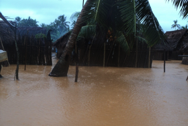
There is also concern that mortality rates have risen due to factors such as rising sea levels and global warming.
References
Andreve, D.J.L. (2008). Kuna Yala mullu: territorio, manejos consuetudinarios. Modelo de gestión ambiental. Comarca Kuna Yala (República de Panamá) . Tesina doctoral, Programa de Doctorado en Cambios Ambientales y Riesgos Naturales, Universidad de Sevilla, 164 pp.
Castillo, B.D. (2016). Problemas limítrofes de la Comarca Kuna Yala, del sector oeste de la Comarca Kuna. Documento inédito.
García Rivas, M., López, W.H., Poot, J.G., Serralde, R.R. y Zepeda, A. (2012). Prevención y manejo de encallamientos de embarcaciones en el Parque Nacional Arrecifes de Xcalak, México: una respuesta temprana para lograr el éxito.
Guzmán, H.M., Andréfouët, S., Guevara, C.A. y Akl, J. (2002). Distribución, estructura y estado de conservación de los arrecifes coralinos de Kuna-Yala (San Blas), República de Panamá. Panamá: Smithsonian Tropical Research Institute. Informe para PEMASKY y NATURA, 44 pp.
Guzmán, H.M., Guevara, C.A. y Castillo, A. (2003). «Natural disturbances and mining of Panamanian coral reefs by indigenous people». Conservation Biology, 17(5), pp. 1396–1401.
Ogden, J. y N. (2010). Field observations over 40 years on the coral reefs of the Comarca Kuna Yala. Informe para el Congreso General Kuna y el Smithsonian Tropical Research Institute.
PEMASKY (1990). Comarca de la Biósfera de Kuna Yala. Plan general de manejo y desarrollo (resumen ejecutivo) . Preparado por el Equipo Técnico de PEMASKY. M & RG, 77 pp.