
The Managalas Conservation Area, in northern Papua New Guinea, was designated as such in March 2017 after over three decades of campaigning for its protection by Indigenous communities and a local NGO called Partners with Melanesians. It covers 214,696 ha of largely pristine rainforest and is home to 22,000 people from 152 clans in eight different language groups. The clans of Managalas have committed all of their land to the conservation area. While this is a great win for conservation, it does mean that there will be compromises going forward between managing livelihood activities, such as the cultivation of gardens and traditional hunting, and realising conservation goals. The community’s vision is one of a sustainable landscape that meets their needs and protects their traditional rights while protecting its biodiversity in perpetuity.
In Papua New Guinea (PNG) 97% of land is under customary ownership, a status recognised in the national constitution. On the one hand, this has meant slow progress in implementing government-managed protected areas, and less than 3% of the nation’s land area is covered by protected areas under a variety of designations. On the other hand, traditional ways of life have a deep respect for the forest, ensuring that much of the land remains in good health. Papua New Guinea is one of very few rainforest nations that still hosts vast tracts of intact forest. It is estimated that over 75% of the forests are in a pristine or near-pristine state, and in many places there is an unbroken corridor of natural habitat from coral reefs and mangroves on the coast, up through a range of forest types to the tree line, and beyond to mountain peaks reaching over 4000 m in elevation. However, with rapidly growing rural populations and economic pressures, the situation is changing.
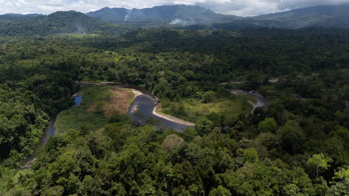
Caption: Bariji River, Managalas. Credit: Russell Wai (Landscape Alliance)
A conservation area that protects community rights and land ownership
In Managalas, the community views conservation as an opportunity to retain ownership of their lands and continue their traditional activities, including managing gardens and agroforests, collecting non-timber forest products and hunting, while generating income to improve their livelihoods. Other potential development paths, such as large-scale mining or logging, would mean losing control of their rights to manage their land and would bring substantial changes to their way of life. Nevertheless, it means that conservation will have to pay its way. The Managalas communities have similar aspirations to others. They would like to be able to send their children to school and university, to afford health care and to be able to buy certain consumer goods, such as smartphones. Can biodiversity conservation offer a sustainable development pathway for the Managalas communities?
In 2023, Landscape Alliance was invited by the provincial governor and the Managalas Conservation Foundation – the community-based organisation set up to manage the conservation area – with funding from the EU, to develop a conservation management plan and initiate conservation-compatible development activities.
So far, the work of the project has focused on three critical areas; (i) governance reforms; (ii) livelihood development through investments in agroforestry (namely, coffee, cocoa and vanilla) and non-timber forest products (primarily, Okari nut -Terminalia kaernbachii); and (iii) establishing a system for community-based biodiversity monitoring. Future activities will likely include forest restoration using voluntary carbon payments, fuelwood production – both for cooking fuel and for drying cocoa and coffee – and agroecological interventions, such as introducing fertiliser trees to improve soil conditions for community gardens. Ultimately, the community hopes to benefit from protecting their rainforests through voluntary carbon and biodiversity payments.
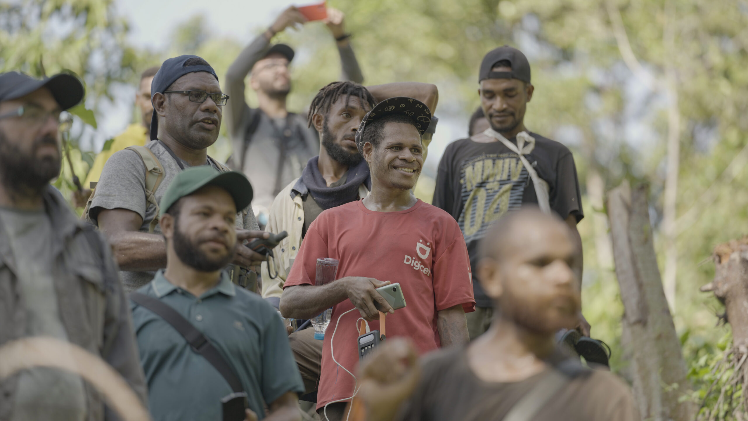
Caption: The biodiversity monitoring team. Credit: Russell Wai (Landscape Alliance)
Community-led biodiversity monitoring reveals the incredible diversity of Managalas
Current information on the biodiversity of Managalas is very limited: there are only a handful of published sources and a few unpublished reports and species records in the Global Biodiversity Information Facility. Nevertheless, these scant records indicate that Managalas supports a highly diverse rainforest. For example, a study from 1964 found that the diversity of trees at 600-800 m elevation was comparable to lowland forests in Borneo and Peninsular Malaysia, making it one of the most diverse forests in the world.
Since the start of the project, we have recorded seven species of Birds of Paradise. The plateau also supports a population of Queen Alexander’s Birdwing butterfly (Ornithoptera alexandrea Rothschild), the world’s largest insect by wingspan and endemic to the region. Only two populations of this butterfly are known, the one on Managalas plateau and one approximately 50 km away on the Popendetta plain. However, genetic studies have found that these populations have been separated for over 10,000 years and, moreover, the population on the plain is highly threatened by habitat loss, making Managalas a critical refuge for this iconic insect.
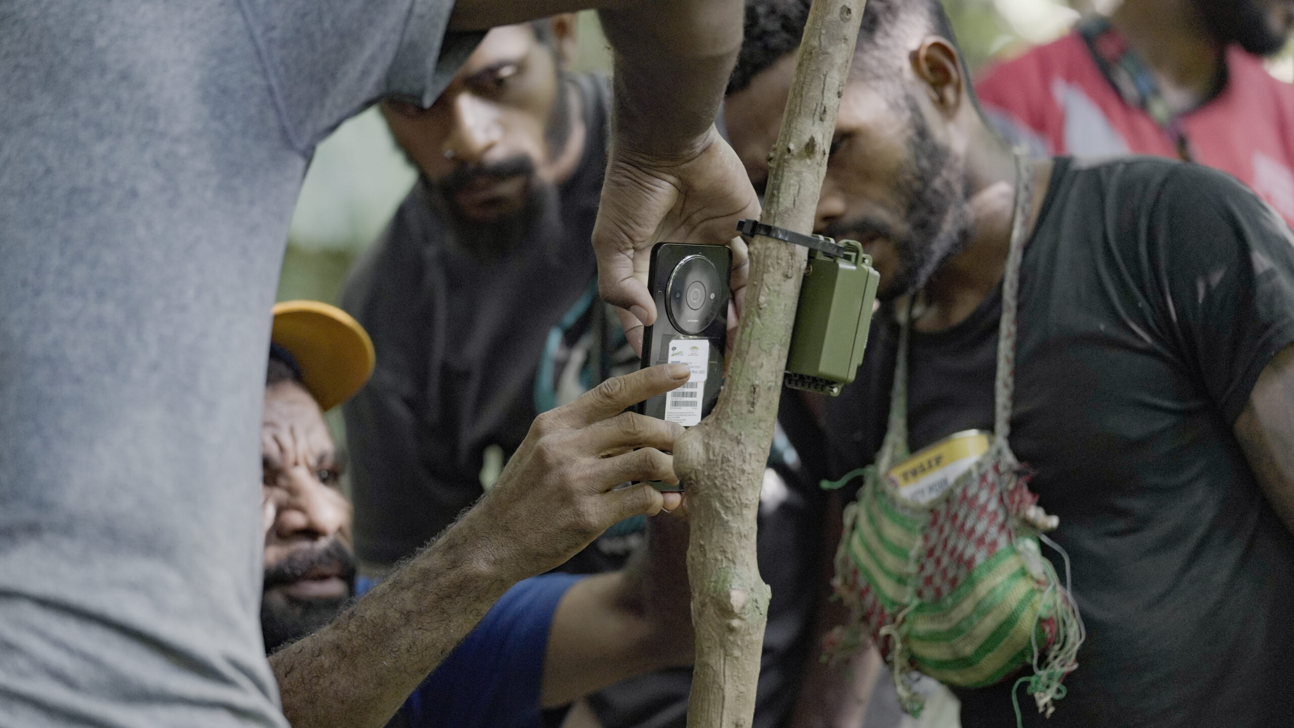
A detailed survey of the biodiversity of the plateau is needed for both conservation planning and to establish a system for monitoring, reporting and verification for biodiversity credits. Hence, Landscape Alliance and the Managalas Conservation Foundation, working together with biodiversity education organisation Map of Life, started establishing a baseline for community biodiversity monitoring in 2025. To do this, activities include camera trapping, passive audio monitoring, eDNA, permanent vegetation sample plots and Local Ecological Knowledge (LEK). Each of these methods provides largely complementary information. For example, camera traps sample mostly mammals and some birds that move about on the forest floor. Meanwhile, passive audio monitoring picks up species that make audible calls, including birds, amphibians, and some insects. The eDNA will be sampled from streams and, therefore, will detect fish, aquatic reptiles, and also DNA washed into streams through rainfall. This last component will include some species that are not well sampled by either camera traps or passive audio monitoring, such as bats, whose droppings are sometimes washed into streams. The vegetation plots will enable us to characterise forest types and assess carbon stocks. Lastly, the LEK survey will provide a historical perspective on the distribution and abundance of selected species and better understand threats to biodiversity.
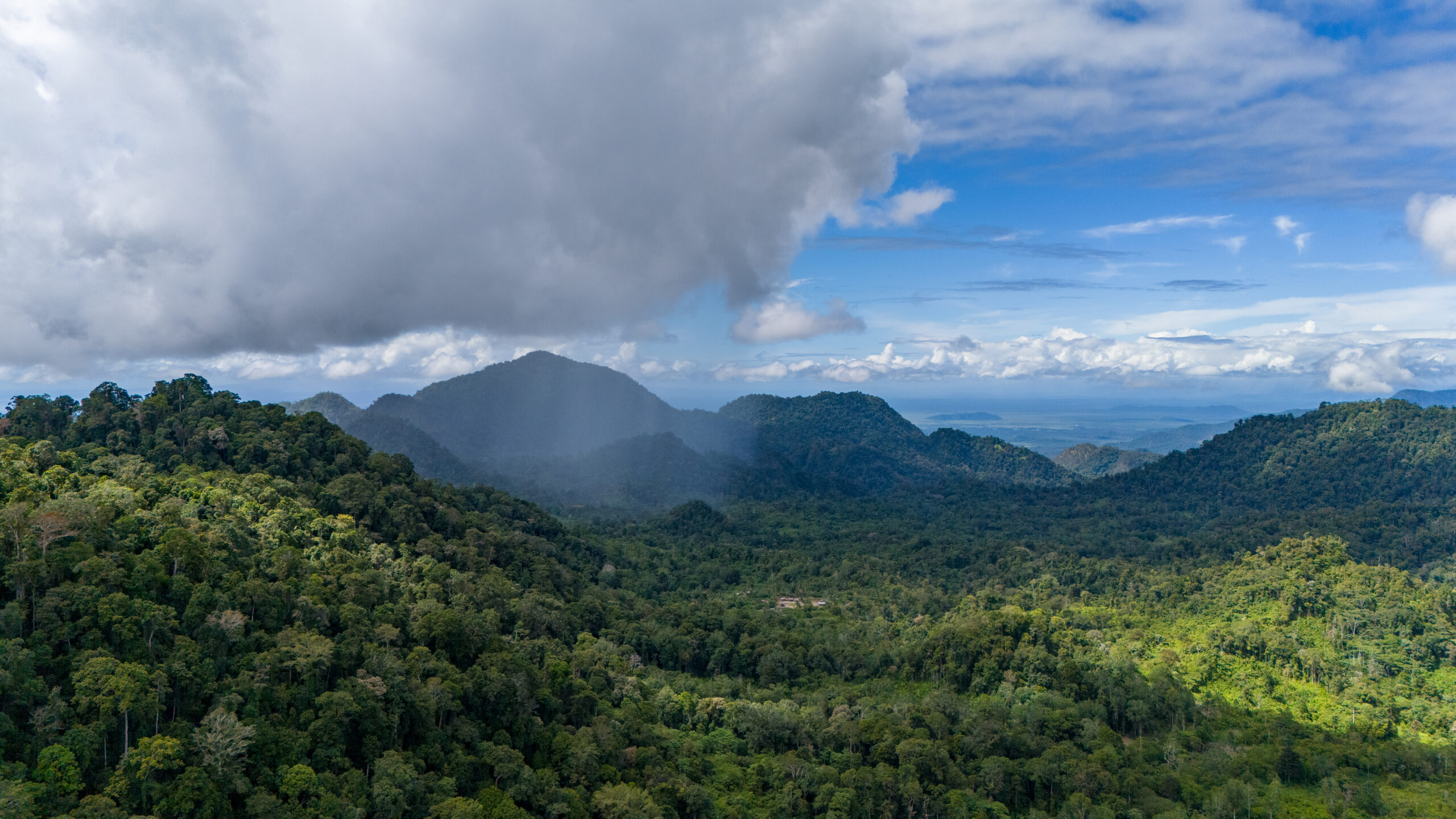
Caption: Managalas landscape. Credit: Russell Wai (Landscape Alliance)
To implement these surveys and ensure community ownership of the process and outputs, Landscape Alliance has trained a group of twenty-five Biodiversity Team Leaders (BTLs) selected from across each of the eight language groups. The BTLs work with the clan elders when surveys are conducted on their land. This means that land-owners are always fully informed as to what is happening on their land. Clan members are also employed by the project as casual labourers, such as guides, porters and field assistants, which brings some direct financial benefit from the project to the communities.
When it is completed at the end of 2026, the camera trap and passive audio monitoring survey will be the largest study of its kind. We divided Managalas into three elevation bands and two basic soil types, and then within each of these six categories, we randomly located three sampling grids. Each grid is 3 x 3 km with 49 stations spaced 0.5 km apart. At each station, the BTLs deploy two camera traps facing opposite directions and one passive audio device, which are left in the forest for 30 days. Hence, by the end of the survey we will have sampled 882 stations for a total of 79,380 device days! Although this may seem very intensive, the grids cover only 7.5% of the conservation area and each station samples only a small area of forest in its immediate vicinity. However, the sampling framework will enable us to model variation in biodiversity according to elevation, soil type, distance from villages and so forth, thereby giving us a clear picture of the distribution of species across the conservation area.
“I first started as a carrier at Grid 57 and I was quite interested in joining the BTLs. Joining the group was a new experience for me. I had never handled a smartphone before I joined the BTLs. I now know how to use a smartphone and the Locus Map app to navigate in the forest. My family is also quite proud that I work as a BTL.”
Anthony Irimai, a Biodiversity Team Leader
Nonetheless, the volume of data generated creates its own problems, which is where Map of Life come in. They are employing automated AI-powered species detection pipelines for efficient data processing. At least, that is the theory. Unfortunately, because of the relative paucity of camera trap and passive audio studies in PNG, the AI models are currently struggling to identify many of the species. Enter again the BTLs, but also a network of biologists familiar with PNG species, who are helping to identify images and calls and improve the AI-powered automatic detection. For example, where the automated detection identified just one unknown species of Forest Wallaby, the team has been able to separate them into four distinct species. In addition, by contributing to global image and audio databases, our work will facilitate future studies and enhance niche modelling, such as through the Map of Life app.
“The biodiversity surveys we are doing now are important because we are now finding out what kinds of animals exist in our forests.”
Harry Avejari, a Biodiversity Team Leader
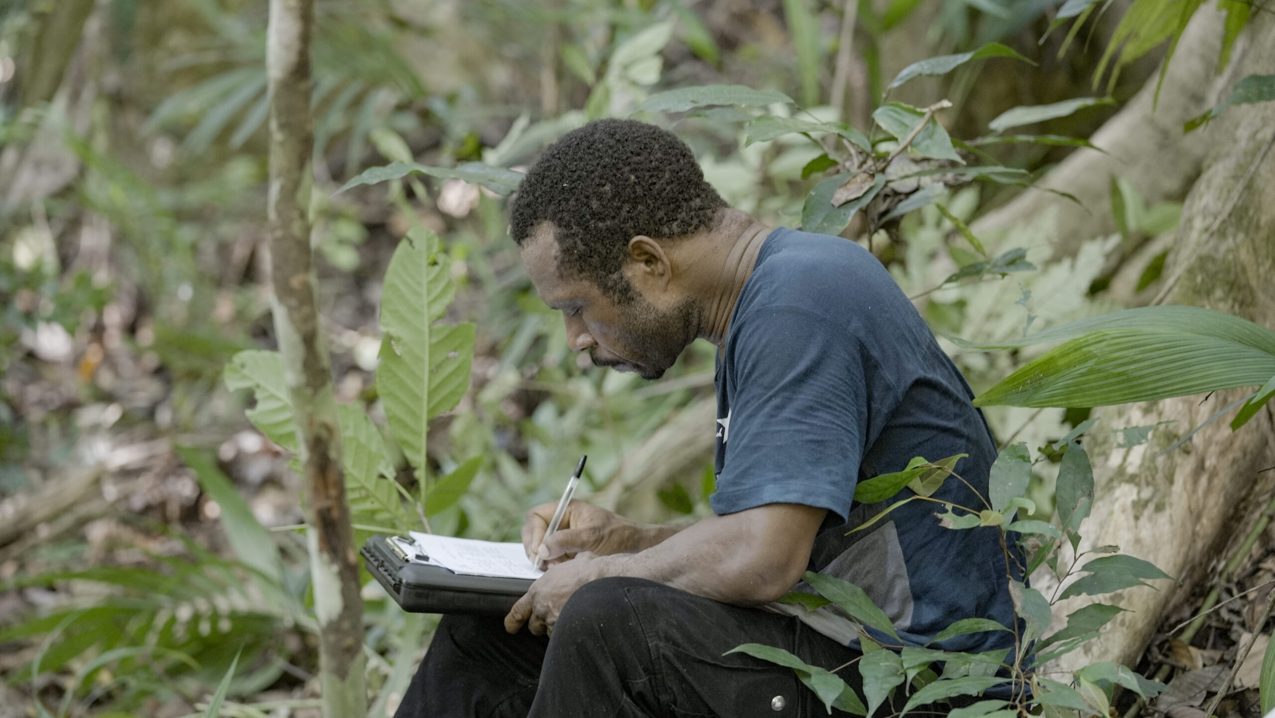
Caption: A Biodiversity Team Leader takes notes on a monitoring trip. Credit: Russell Wai (Landscape Alliance)
While still early days, the camera trap survey has already uncovered some rarities. For example, we got a great photo of a Giant Bandicoot, a species that is very rarely recorded and whose distribution is poorly understood. We have recorded Dorian’s Tree Kangaroo, which despite its name, does come down to the ground. One of our camera traps recorded a Goshawk capturing a Spiny Bandicoot, the only time such a predation event has been recorded. We recently photographed an Echidna, which although the local communities had said was present had not been recorded, and moreover it is outside the known distribution of Echidna species. We think it is a Long-beaked Echidna but unfortunately we only had a rear-view, so we will need to wait for a better photo for confirmation.
Monitoring biodiversity is complicated and requires collaboration. In Managalas, we selected a set of survey methods that can be implemented by trained community members, ensuring ownership by the community. However, input from scientists is required to select appropriate methods, design the sampling framework, provide training on implementation of the protocols, process results – even if much of it is being automated – and to model and interpret results. The project funds an educational scholarship programme and in the future, we hope that community members might be able to take over an increasing proportion of these roles.
“The work we are doing now as BTLs is the first of its kind since the establishment of the MCA. This means a lot to us here in Managalas. After the declaration of the MCA, people can actually see that we are doing important work. I believe this is university level work that we are doing. We can use this experience and knowledge if we decide to enter tertiary institutions later on for further studies.”
Ivan Mambari, a Biodiversity Team Leader
Through our work we estimate that it will cost approximately US$2.5M per year to manage the Managalas community conservation area, including governance, such as support for holding community meetings, small scale livelihood interventions, training and technical support. This may seem like a lot, but it works out at less than US$12 per hectare per year. Let’s hope that carbon and biodiversity credits can meet these costs and ensure that Managalas continues to be managed for conservation.
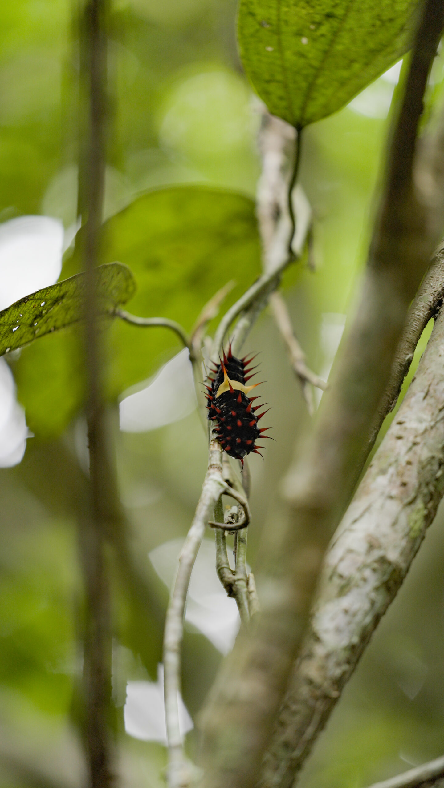
Caption: A Queen Alexander’s Birdwing butterfly caterpillar. Credit: Russell Wai (Landscape Alliance)