The Wapichan conserved headwaters area offers a unique contribution to global biodiversity and to Guyana’s 30×30 target.
Ancestral stewardship of the Wapichan headwaters
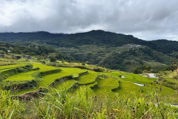
The Wapichan people of southwestern Guyana have protected the forests in the eastern half of their wiizi (territory) for generations. The area, which spans about 1.2 million hectares (almost 3 million acres), is home to networks of sacred mountains (all of which are named and have legends associated with them), sensitive sites, resources used in cultural ceremonies and rituals, and the headwaters of major river systems, including the Essequibo, Kuyuwini, Rewa, Rupununi, and Kwitaro rivers.
The area’s unique and diverse ecosystem includes some of the most fertile lands in the region1 and high levels of biodiversity2. The wider Rupununi region of Guyana is estimated to be home to more than 5,400 known species, many of which are highly endangered globally.
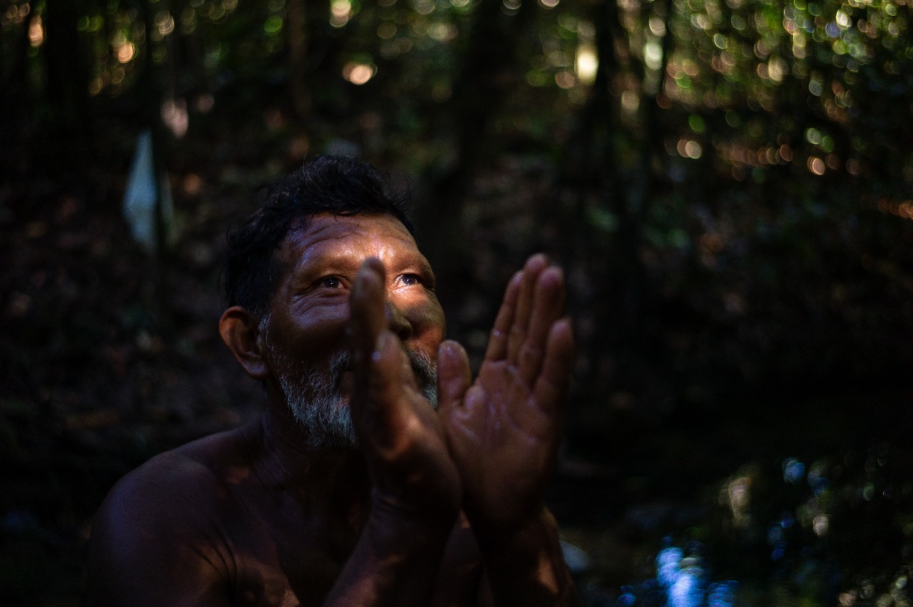
Ancestral stewardship of the Wapichan headwaters, sustained through inter-community agreements and formalised in the Wapichan Territorial Management Plan, reflects a long-standing commitment to conserving this ecologically vital region. Credit: FAO/Marlondag.
Author
- Lan Mei, Forest Peoples Programme, and Gavin Winter, South Rupununi District Council
Ecosystems
- Tropical forests
Topics
- Land rights and tenure
- Conservation and sustainable use
Type
- Short-form
Date
- This case study is included in the report Enabling Pathways for Rights-based Community-led Conservation, published on September 17, 2025, by the Rights and Resources Initiative, the ICCA Consortium, and the Forest Peoples Programme
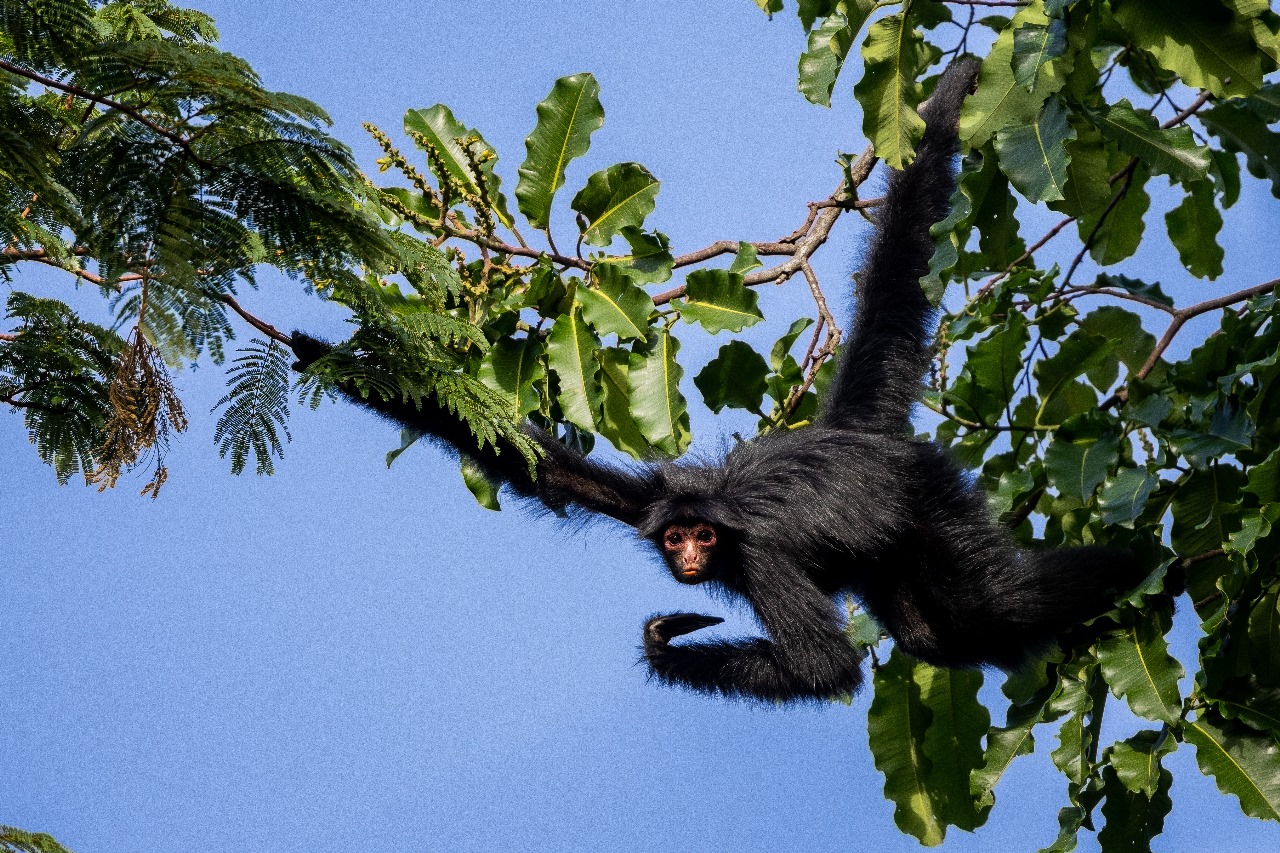
Black spider monkey (Ateles paniscus), a vulnerable species on the IUCN Red List. Credit: FAO/Marlondag.
During the rainy season, the Amazon and Essequibo river basins connect via the Takutu and Rupununi river basins, creating two important biological and geographical portals that allow for the exchange of species across different ecosystems.
Despite generations of leaders pushing Guyana’s government to recognise the Wapichan people’s ownership over their collective territory since Guyana’s independence in 1966, the Wapichan people’s stewardship over the headwaters region remains unrecognised by the government.
Rather than recognising the importance of the area for conservation, the government has threatened the environmental and cultural integrity of the area by granting gold-mining concessions over Marudi Mountain, which sits in the middle of the headwaters area, and turning a blind eye to the illegal mining happening inside those concessions. Active and largely unregulated mining in the area is already tearing down Mazoa Hill and, coupled with proposed blasting activities, this is poised to lead to greater ecological and cultural destruction.
The Wapichan communities of the South Rupununi, collectively represented by the South Rupununi District Council (SRDC), began to formalise their commitment to conserve the headwaters region in 2010, through a series of inter-community agreements, and then in 2012 in their Wapichan Territorial Management Plan.
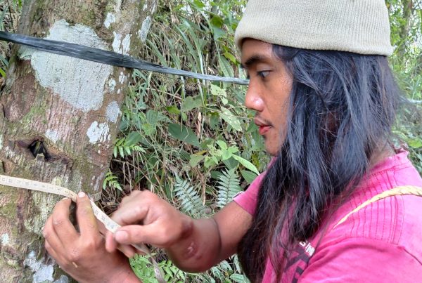
The SRDC established a monitoring program in 2012, training community monitors to observe mining and other activities and to document their impacts. They have also developed wildlife and headwaters management plans, and cultural heritage policies, which elaborate upon their territorial management plan.
The Wapichan people developed and are implementing these management plans to demonstrate their ability to sustainably manage their lands. In 2023, their expertise and efforts were recognised by the Guyana Wildlife Conservation and Management Commission through an MOU which recognised the authority of the SRDC to manage a wildlife checkpoint at one of the most trafficked entry points into their territory. Their commitment to conservation of the area has more recently been reaffirmed in their village sustainability plans which they are mandated by the government to develop.
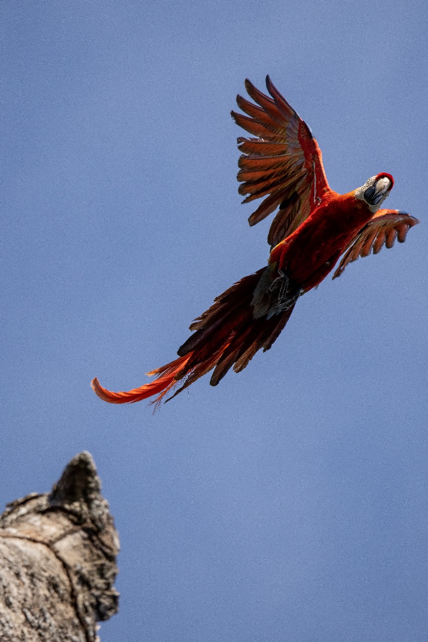
Scarlet macaw (Ara macao). Credit: FAO/Marlondag.
The wider Rupununi region of Guyana is estimated to be home to more than 5,400 known species, many of which are highly endangered globally.
Challenges to rights-based conservation
Legal recognition and policy support for the Wapichan people’s work to conserve their headwaters area is urgently needed to protect the area from further destruction by mining and future threats.
Unfortunately, the current legal framework provides limited options for formal support for rights-based conservation. Land ownership rights in protected areas are not recognised unless an indigenous community had pre-existing title and chose to designate part of that title as a protected area. Despite decades of advocacy to secure title over the headwaters area, the government has continuously failed to title those lands to the Wapichan people.
The government has on numerous occasions pointed to third-party interests – for example, mining at Marudi Mountain – as one obstacle to land titling of parts of the Wapichan conserved headwaters area. It has also recently informed communities that forest areas are unlikely to be titled to communities anytime soon but that they could give up their claims over those forest areas to receive title over parts of their savannah lands. Although no explanation was given to communities for this, it is interesting to note that the government since 2020 has entered into a carbon-trading scheme covering the entirety of the forest area in the country.
The only other legally recognised form of conserved area in Guyana is a protected area over non-titled lands. One such protected area, the Kanuku Mountains Protected Area (KMPA), was established over parts of Wapichan wiizi without the communities’ consent in 2011, leading to government-imposed restrictions on resource use by community members. For example, a new draft management plan for the KMPA describes “housing development projects” by villages – in other words, villagers using timber from the protected area to build their homes – as a key threat to the protected area.3
From the communities’ perspective, protected areas are just another mechanism by which government plans are forcibly displacing them; in the early 20th century, communities were forced out of their savannahs to make space for cattle-ranching investments, and moved back into their forests; now, with the establishment of protected areas, they are starting to be displaced out of their forests.
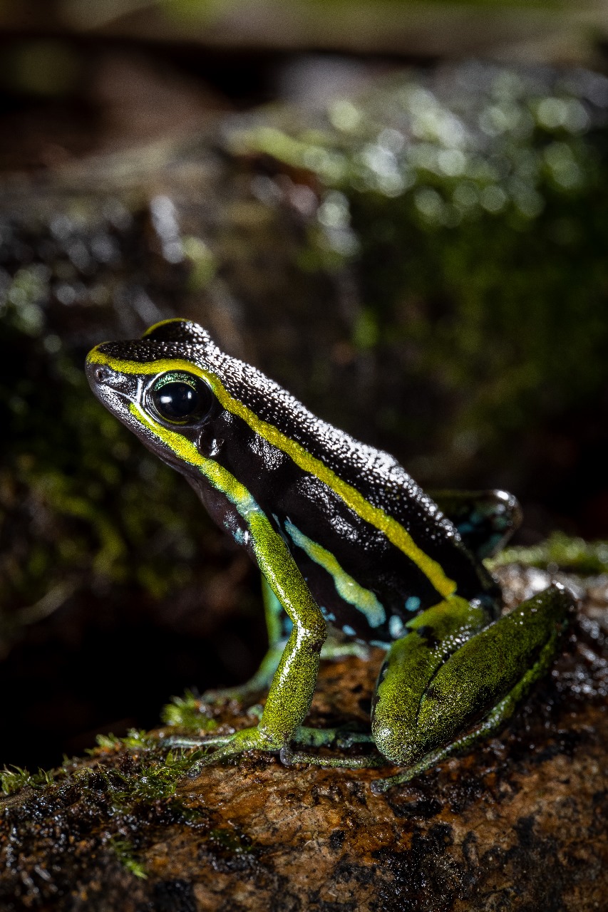
Three-striped poison frog (Ameerega trivittata). Credit: FAO/Marlondag.
Opportunities for both the Wachipan people and the Guyana government
The Kunming-Montreal Global Biodiversity Framework of 2022 presents a new opportunity for the Wapichan people to advance recognition of their conservation efforts. In line with the framework, the government of Guyana has publicly committed to doubling its conserved areas by 2025 to 17% of the country’s area, and to achieving its 30×30 target.4The Protected Areas Commission has also stated its intention to revise and update the Protected Areas Act.
However, the government must make sure that indigenous rights are not violated in the process of increasing conservation efforts. Historically, the establishment of the only indigenous-owned protected area in Guyana to date – Kanashen Amerindian Protected Area – was not community-led and has resulted in negative unintended consequences, including displacement of villagers out of the community and negative impacts on neighbouring communities. Notably, and ironically, although it is widely reported that a major threat to Kanashen is mining in Parabara, one of the SRDC villages which borders Kanashen, it is in fact residents of Kanashen who are illegally mining in Parabara. The restrictions on resource use in Kanashen have also led to overuse of wildlife by Kanashen residents in Parabara’s lands and resource-use conflicts.
The SRDC has already started approaching relevant government agencies to engage in discussions about recognising the Wapichan conserved headwaters area and its contribution towards the government’s 30×30 target. Working with the SRDC to recognise their headwaters area as an indigenous-owned and conserved area is a significant opportunity for the government. The SRDC’s proposal is the first time an Indigenous People have presented their own proposal for conservation to the government.
Advancement of the SRDC’s proposal to contribute an indigenous-owned conserved area to the national 30×30 target requires much stronger political support, however. Despite legislation authorising various government agencies to make decisions in various sectors, in practice all decisions are taken through Cabinet, and particularly the president and vice-president. The agencies responsible for the environment, forests, mining, law enforcement and border control will also need to support the SRDC in exercising its authority over illegal mining activity in the area.
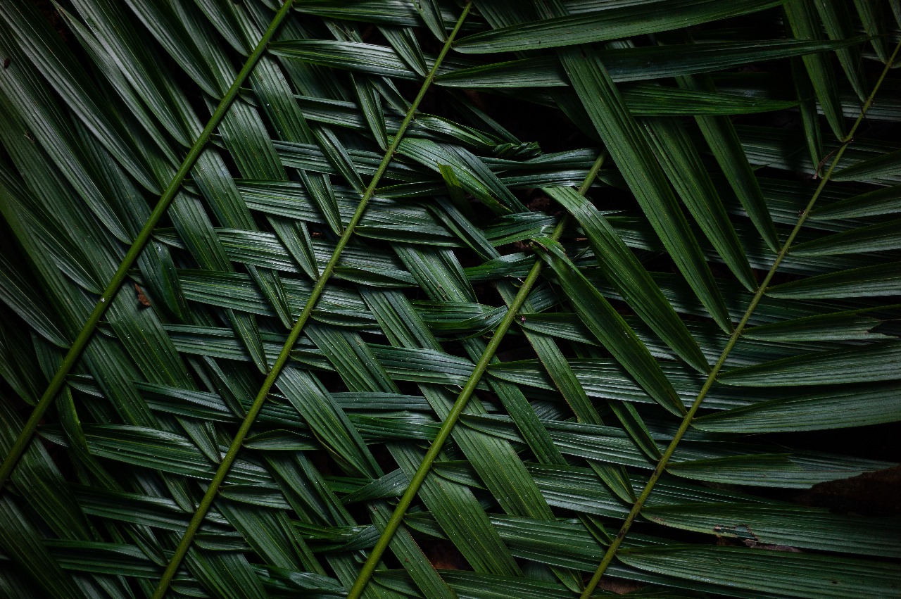
Traditional palm-leaf weaving used by the Wapichan people in Guyana for numerous activities, including housing, fishing, gathering and basket-making. Credit: FAO/Marlondag.
The South Rupununi District Council ’s proposal is the first time an Indigenous People have presented their own proposal for conservation to the government.
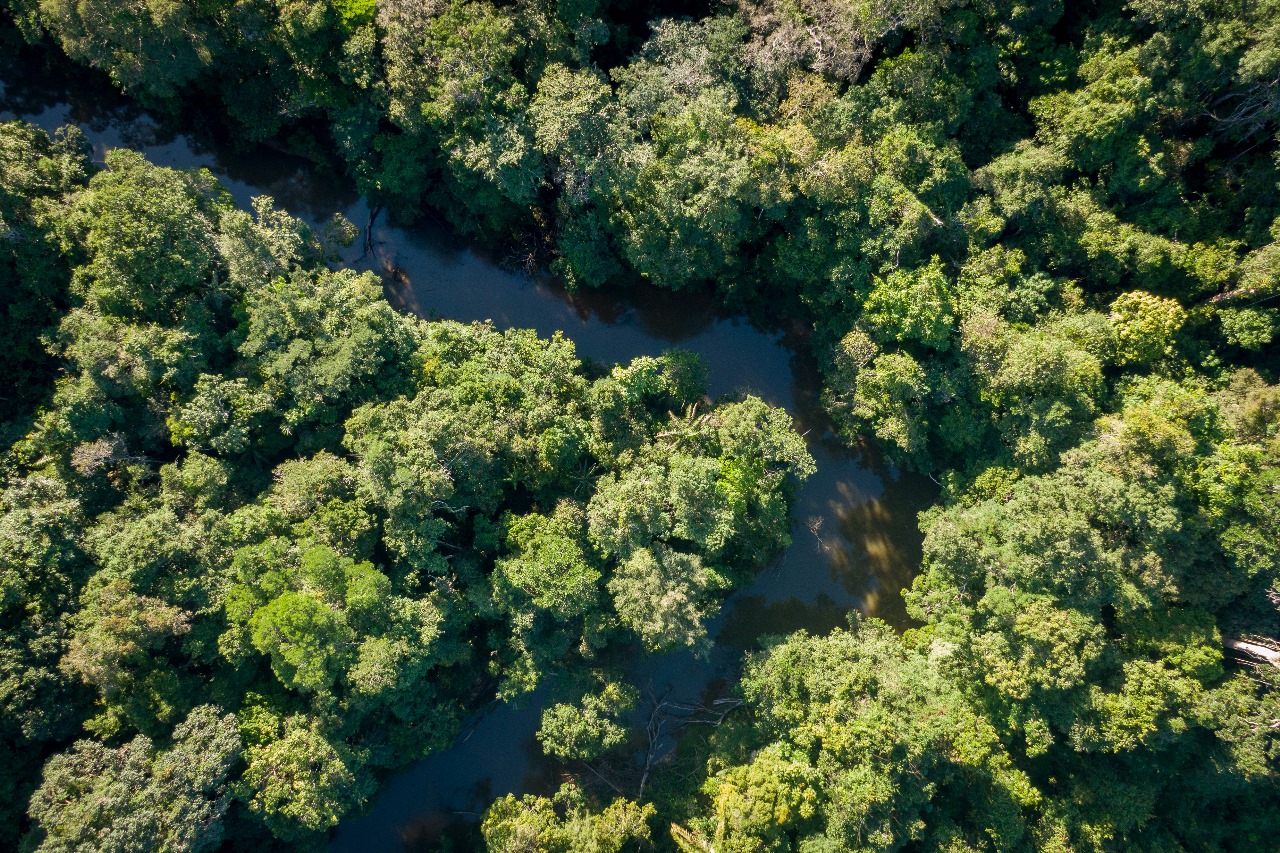
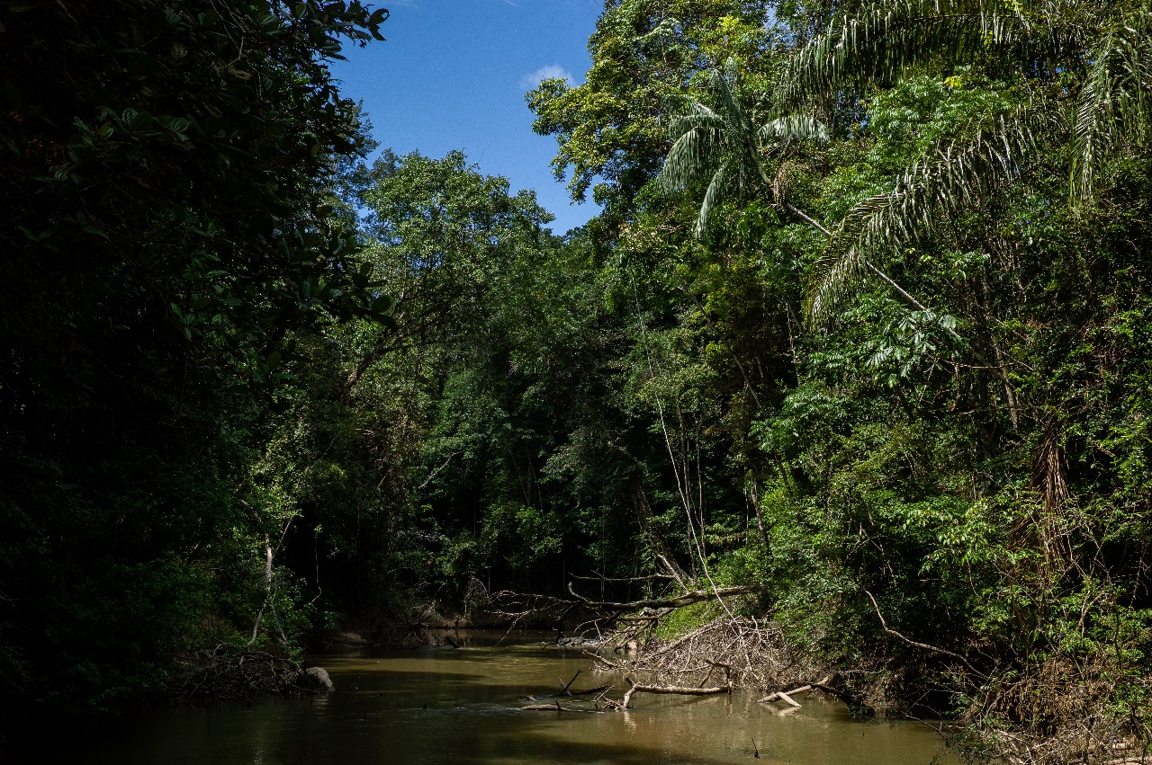
The Rupununi River and surrounding forest ecosystem.. Credit:FAO/Marlondag.
Wapichan management plans support the sustainable stewardship of biodiverse lands. Credit: FAO/Marlondag.
Recommendations to decision-makers
The Wapichan conserved headwaters area offers a unique contribution to global biodiversity and to Guyana’s 30×30 target. Government agencies and officials should without delay issue title over those lands to the SRDC villages and begin the process of sustained dialogue with the SRDC to design and develop a strong implementation plan for managing the area.
The government must support the SRDC to develop and implement proposals to ensure that the SRDC has the necessary authority and support to enforce their management plan.
If successful, this conserved area would offer a positive example of true indigenous-led conservation that respects Indigenous Peoples’ self-determination, land, resource, and participation rights.
References
- Government of Guyana (1969) Report by the Amerindian Lands Commission, Government of Guyana, August 1969, pp. 75–76. At: www.parliament.gov.gy/documents/documents-laid/14210-report_by_the_amerindian_lands_commission_august_1969.pdf
- Alonso, L.E., Persaud, J. and Williams A. (eds) (2016) Biodiversity assessment survey of the South Rupununi Savannah, Guyana, BAT Survey Report No. 1. WWF-Guianas, Guyana Office. Georgetown, Guyana. At: wwflac.awsassets.panda.org/downloads/wwf_bat_sr_low_res_1.pdf
- Protected Areas Commission (PAC), Guyana (2024) Kanuku Mountains Protected Area – Management Plan 2024-2028, First draft. Georgetown: PAC, Guyana.
- Stabroek News (2024) ‘Guyana to double legally protected areas’, Stabroek News, 13 July 2024.